by Kevin P. Corbley
As Land Rights Manager for Trinity River Authority of Texas (TRA), James Kelly gets a lot of calls about ownership details, lease payments, and location information relating to the nearly four thousand properties crossed by TRA water and wastewater pipelines. One inquiry that came to Kelly in mid-summer 2007, however, stands out in his mind from the hundreds that preceded it - because he was able to provide an answer almost instantly.
“Someone had a question about an easement, and we were able to pull the information right up [on the computer screen],” said Kelly. “We used to have to search through 25 filing cabinets...to answer them. It might take two days.”
The difference, Kelly said, is that TRA has initiated a major automation project that will eventually make the complete database of land records accessible in digital format to anyone in the utility through a new land management system which is fully integrated with an enterprise-wide GIS. The call Kelly remembers with such satisfaction related to one of TRA’s land ownership records captured in the new system and digitized into the GIS. He simply clicked on the area of the GIS map described by the caller and instantly got all of the information he needed which included viewing a scanned copy of the original land rights agreement and all its related file documents.
When the automation is completed in late 2007, TRA will have a digital land records system that shares data with other business systems as well as the enterprise GIS. More importantly, every land rights agreement will be accurately mapped and georeferenced to the facilities and engineering layers in the GIS. TRA personnel will be able to query and visualize where utility pipelines and infrastructure are located relative to specific rights of way, leases and other land rights agreements.
“Having a land records database that’s linked to the GIS is up-and-coming technology,” said Kelly. “It’s going to benefit everyone at TRA.”
New Trend in GIS
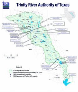
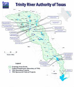
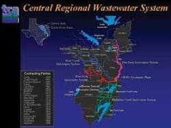
Created by the Texas Legislature in 1955, TRA is responsible for water and wastewater treatment in the Trinity River basin, which covers nearly 18,000 square miles. TRA’s eight major water treatment facilities serve 3.5 million residents in Eastern Texas, including parts of the Dallas-Fort Worth and Houston metropolitan areas. The largest facility is the 162 mgd Central Regional Wastewater Treatment Plant with more than 200 miles of pipelines spread over 450 square miles.
Before the start of the GIS implementation in 2004, TRA had no enterprise geospatial technology. To provide the infrastructure for its GIS integration, TRA decided to install the ArcGIS and ArcSDE software of Environmental Systems Research Institute (ESRI) of Redlands, CA, using an Oracle database. The initial development was contracted to Black & Veatch, a large engineering consulting firm, and focused on digitizing and georeferencing the pipelines, engineering facilities and assets relating to the Central Treatment Plant. TRA had opted to go with the enterprise version of the GIS, which would give all utility personnel working at any location access to the system on their desktop computers via TRA’s intranet.
Implementation started at the Central Treatment Plant and will be expanded to other TRA facilities from there. Initially, there were no firm plans on when or how the right of way and other land asset boundaries would be added to the GIS. But shortly after the project began, the TRA Land Rights Department started to become increasingly frustrated with the Access database where details of its land rights agreements were stored.
“[Microsoft Access] was slow and wasn’t designed for property data; we had too many records for it,” said Don Tucker, Manager of General Services for TRA.
At this point, TRA began discussions with LandWorks Inc., a Houston-based software and GIS services company that specializes in implementing enterprise land asset management systems. The firm offered its LandWorks Property Management (LPM) software, a customizable solution designed for storing, retrieving and managing the rights, obligations and ownership in rights of way, leases and other land agreements. In addition, the solution could interface with other business systems, including facility management, accounting and document management software.
The Land Rights Department was already leaning towards implementation of the LPM system when it learned that a complementary package called LandWorks GIS was also available which provided seamless integration with ESRI’s GIS technology. This package would provide the connection between the land records system and the enterprise GIS, giving all TRA personnel access to the property information. Almost overnight, two separate automation plans became one integrated project.
“Automation of land records and linking them to a GIS is definitely a growing trend among water and wastewater utilities,” said Rich MacDonald, LandWorks Senior Account Executive. “In the early days of GIS development, utilities focused on getting their pipeline networks and facilities accurately mapped in the GIS system, which was a big job by itself, so many implementations didn’t initially include land records. Now that most water utilities have their facilities mapped, they are turning to the land assets on which the facilities are built and focusing on getting this information in the GIS as well.”
MacDonald explained that the enterprise capabilities offered by today’s GIS technology have prompted users of geospatial technology to look around their organizations to see which personnel can benefit from using a map-based system to access information to help manage the enterprise’s operations and assets. This naturally leads them to ask what other automated systems can be integrated with the GIS to spatially enable the data to facilitate faster and better decision making through the enterprise-wide flow of information. For a typical water/wastewater utility with pipelines crossing thousands of properties, the logical step is to make land asset management part of the GIS.
Automating the Records
TRA contracted LandWorks to implement its LPM and GIS solutions starting with a pilot in January 2005. Focusing on the property records relating to the Central Treatment Plant, the pilot was designed to prove the integration would work and to establish an efficient workflow for the automation process. By June, the objectives of the pilot had been achieved, and implementation of the land asset management system moved into the data capture and loading phase.
One result of the pilot was the decision to key the land rights information into the LPM database from scratch rather than try to programmatically convert the data from Microsoft Access. This first step in the automation process occurred at TRA where Land Rights personnel began cleaning out the 25 filing cabinets holding the paper legal documents pertaining to each land right. They scanned every document and delivered the digital files to LandWorks for further processing.
LandWorks’ land records analysts reviewed each scanned document and extracted key information, such as the legal description, grantor name and address, payment arrangements, obligations, abandonment clauses and any other provisions important to managing the land right from both a legal and operations perspective. These pieces of information were entered manually into more than 80 pre-defined fields to populate the new land records database. Each database record contains an identifier linking it back to the corresponding scanned documents.
Once the database record for a land right agreement was completed, a polygon representing the boundary of the land parcel covered by the agreement was created in the GIS and linked back to the related information in the LPM database using the Parcel Edit Tools developed by LandWorks. Each polygon was assigned to a GIS layer in ArcGIS based on the type of land right. As a map layer in the GIS, the parcel boundary was aligned with the pipelines, manholes, plants and other infrastructure layers.
At the same time the polygon was generated, it was linked back to its appropriate record in the LPM database. This is a critical integration step because it provides access to the entire land records database and scanned images directly from the GIS map. This gives a TRA GIS user the option of performing either a spatial or relational search for a specific agreement. For instance, a user can click on the map, enter the legal description, or key in an address to have the GIS locate a given property and then zoom in to it on the map. Or the user can query the database directly to locate and view land records.
“Analysis and query tools allow the user to search for any land right with a minimum amount of information, such as a grantor’s name or agreement number,” said MacDonald. “And powerful sorting routines can be applied to locate multiple parcels, such as all properties owned by one individual or those with leases expiring this year.”
Benefiting from Integration
The TRA Land Rights Department is already routinely using the GIS and land records system for queries relating to properties in and around the Central Treatment Plant, where much of the automation work has focused. They say the primary benefit of the new capability in their department is the speed with which they can access land information now that they don’t have to dig through paper files.
In the case of a pipeline maintenance emergency, for instance, the department can pinpoint the location on the GIS map and instantly determine what ingress and egress rights TRA has for the properties involved, including the adjoining landowners and their contact information. More complex spatial searches are possible for the first time too. For example, Land Rights personnel can isolate one pipeline in the GIS and pull up database information for all the properties it crosses over its entire length or just a segment.
Taylor Huynh, Manager of Personnel Services at TRA, predicts each individual department within the Authority will experience its own advantages as personnel begin exploring the capabilities of the integrated systems. TRA engineering and maintenance personnel are beginning to use the GIS to track the installation dates of various pieces of equipment, which are archived in MAXIMO, (a maintenance management package) so they can establish regular repair schedules. Images and videos of repairs made to pipelines will be available when this project is complete. In addition, TRA intends to integrate this system to the accounting module of the Lawson ERP system in order to retrieve payment details of land tracts.
“The biggest benefit is being able to share all of the information [across the enterprise] in real time,” said Huynh.
About the Author:
Kevin Corbley is a consultant specializing in geospatial technology. He may be reached at www.corbleycommunications.com.


