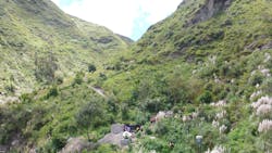
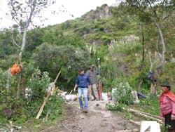
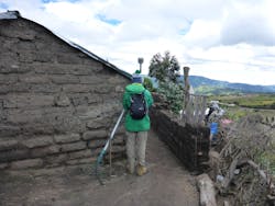
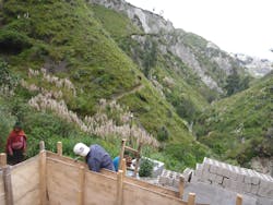
At an elevation of roughly 3,600 meters (11,800 feet), Curingue in the Andes mountains of Ecuador is an isolated rural community. There is no cellular phone service and only limited electricity for the roughly 210 people living there. There is also no centralized water supply system. The lack of reliable water means villagers face hardship and increased risk of health issues.
Engineers Without Borders (EWB) offered to install infrastructure that could deliver water to the village. But when EWB proposed to provide a water supply system, they needed data about water sources and the area’s steep terrain. They soon discovered that there were no existing large-scale maps or geographic information for the area. To plan the work, EWB first needed to develop accurate maps and elevation information.
Developing maps would still require significant effort, with volunteers manually surveying the rough terrain. The remote location also had no existing geodetic control points — a complication that could add time and uncertainty to the mapping effort.
A long-time user of global navigation satellite system (GNSS) technologies, Hamilton examined approaches to gathering accurate data for the mapping effort. One option included conducting long-observation GNSS sessions and then post-processing the data to establish reference stations for real-time kinematic positioning (RTK). But accessing data from Ecuador’s network of continuously operating GNSS reference stations (CORS) proved problematic. In addition, Curingue’s mountainous landscape made using conventional RTK with ultra-high frequency radios unfeasible.
Working in Difficult Terrain
To achieve accurate and reliable positioning, Hamilton used a positioning service by Trimble Geospatial called CenterPoint RTX. The service enables users to achieve survey-grade GNSS positioning (better than 2 cm horizontal and 5 cm vertical accuracy) anywhere on Earth. Hamilton had gained experience using real-time extended (RTX) positioning on projects in the U.S. and Canada, and he was sure it could provide the needed accuracy in Curingue.
The team needed one week to complete all the survey work. They worked along the route of the proposed pipeline collecting GNSS data to compile critical vertical profile information for the pipe. They also located ravines and roads that would affect the construction. Finally, they visited each house in the village to collect position and elevation data.
“There was absolutely no way to do this without a correction service,” Hamilton says.
Building Upon Innovation
It didn’t take long for RTK to push the use of total stations aside for most electric line surveying. RTK provides good accuracy but still relies on a GNSS base station and radio data links to send data from the base to the rover.
Real-time GNSS networks (RTN) make surveying easier and more convenient — but only in a specific geographic area served by the network. Positioning accuracy quickly degrades outside of the network’s coverage area. Furthermore, RTN is dependent on cellular communications, which are often nonexistent in remote areas.
In contrast, RTX provides easy, convenient, and highly accurate positioning without the added dependencies of RTN or RTK.
EWB will use the mapping to establish a durable, sustainable water supply that will improve the lives of Curingue residents. Work is already underway on the collection point, which includes its own storage tank and pump station. Hamilton is planning a return visit to Ecuador, where he will work on a similar project in a different village. A positioning service will again be his primary tool for accurate GNSS positioning in the remote mountains. WW
About the Author: John Stenmark is a writer and consultant working in the geospatial, engineering, construction, and associated industries. A professional surveyor, he has more than 25 years of experience in applying advanced technology to surveying and related disciplines.
Published in WaterWorld magazine, June 2022.
About the Author
John Stenmark
John Stenmark is a writer and consultant working in the geospatial, engineering, construction, and associated industries. A professional surveyor, he has more than 25 years of experience in applying advanced technology to surveying and related disciplines.


