CSO monitoring meets tough reporting requirements
By Angela Reid
Legislation governing Combined Sewer Overflow (CSO) reporting is tightening standards and making real-time flow monitoring equipment more attractive and affordable to municipalities.
The lack of reliable, cost-effective technology is perhaps the greatest reason for the delay in strict legislation; however several US cities are proving that wireless, real-time monitoring can now confirm the integrity of data recorded at CSO sites.
Reporting requirements vary from state to state, but every jurisdiction has mandated some form of overflow monitoring. Some of the toughest legislation requires that overflows be reported on a daily basis, 365 days per year. Reports often require that duration and volume of each overflow event be documented. Undoubtedly, communities with 100 or more CSOs find this task daunting...and expensive.
Attempting to satisfy these requirements, several cities implemented daily or weekly visual inspections of CSO sites. Techniques for confirming events include fluorescent chalk, wooden bobbers and similar rudimentary tools. Complications can arise from these methods, such as storms washing away the chalk or bobbers, overflow points being located far away from manholes and the inability to accurately deter-mine if an overflow has occurred. Volumes and durations can only be guessed.
Some cities have installed flow monitoring equipment that is downloaded on a regular basis and generates reports from recorded data. Flow monitors can provide durations and measure volume, but if a sensor becomes fouled or damaged, data that is required to meet reporting requirements can be lost, resulting in fines.
Flow monitoring is a viable solution now that GEOtivity wireless flow monitoring systems can confirm data integrity as it is recorded. These systems, available from GEOtivity, a US company based in Indianapolis, Indiana, range from two to more than 100 sites with many projects being installed over five or six years. Data is sent wirelessly, via the Internet, where it is made available on website maps, customised for each community. GEOtivity data analysts and clients view this data real-time, as it is uploaded to the Internet at user-defined intervals. This means that if there is a problem with data or equipment, it will be identified the same day, not two weeks later when the data is downloaded.
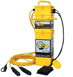
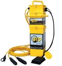
GEOtivity uses a redundant sensor system consisting of two pressure depth sensors and a float switch with a capacity up to 16 sensors. By having three sensors in place, actual overflow events can be confirmed, and there is always a back-up sensor if one gets damaged due to environmental conditions. Sensors and data logger electronics are housed in a waterproof enclosure and powered by batteries that last six to twelve months. A small wireless antenna is installed to transmit the data using existing cellular tower networks and the new Global Packet Radio Service or Cellular Digital Packet Data (CDPD) communications services.
The system can be used to send alarms in addition to uploading real-time data. When flow reaches a pre-defined depth, an alarm can be sent via email or text message to cell phones and pagers. By integrating CSO monitors with wireless rain gauges, the system can check rainfall and differentiate between wet and dry weather events. In some instances, this ability has prevented dry weather overflows by alarming city maintenance staff to remove blockages.
All recorded data is archived on the website map where it can also be plotted in line and scatter graphs, or downloaded into an Excel spreadsheet for further analysis. At anytime, from any location in the world, data can be viewed, analysed and discussed by one or several people.
The need to monitor and prevent sewage discharges is crucial and mandatory given growing populations, aging municipal infrastructure and the stressed natural environment. Wireless flow monitoring has proven to be an affordable replacement for old-fashioned visual inspection methods. It provides detailed and useful flow data for reporting to regulatory authorities, and planning long-term municipal infrastructure development.
Author's NoteAngela Reid is a regional manager for GEOtivity Inc, based in Indianapolis, Indiana, USA.


