Florida County Speeds Planning with Mapping System
Hydrology and stormwater control are a major concern for local government engineers everywhere, and especially in Pinellas County. While it is Florida's third-smallest county, Pinellas is a peninsula bounded by the Gulf of Mexico on one side and Tampa Bay on the other, with 588 miles of vulnerable coastline and a high population density of 3,290 people per square mile. To stay ahead of the rains, the county has mapped out the contours of almost every inch of its terrain to predict which areas are likeliest to flood.
And when roads and park facilities are built, engineers at the Department of Public Works use a series of Autodesk products to manipulate land maps, design structures, produce 3-D models, collaborate on projects, and bid jobs out to contractors.
Early Forays into GIS
Pinellas County had a head start on applying new technologies because of its early commitment to Geographic Information Systems (GIS). Since 1986, the county has steadily cultivated a huge graphic database of digitized maps, aerial photographs, geodetic survey points and other data that has touched almost every area of county government.
Information that is usually scattered across different paper sources and computer records has been unified into one repository with many layers.
Pinellas County first implemented a Vision database - an Oracle-driven, map-based enterprise system later acquired by Autodesk - at a time when only four other jurisdictions in the United States had one. The county developed a centralized GIS called Enforcer, which allows police officers to track sexual predators or view concentrations of recent crime activity through Web-based maps that run on Autodesk MapGuide.
Most recently, the county was once again among the first in the nation to adopt ProjectPoint (formerly Buzzsaw), Autodesk's online project collaboration service. The system allows Pinellas project managers, engineers and outside contractors to communicate and exchange materials, such as project plans, over a secure Web site.
Managing Storms
At the Department of Public Works, which builds and maintains about half the county's roads as well as park facilities, drainage systems and beach renourishment projects, more than 50 employees use Autodesk's Land Development product suite - Land Desktop, Civil Design and Survey - as a design tool. Among their main tasks is controlling how any new road, parking lot or other structure will affect the flow of stormwater.
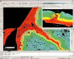
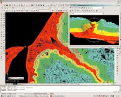
Larry Solien, the department's Engineering Applications Manager, said teams of government surveyors (or private contractors) collect point data at a job site to compile an electronic "field book." That data is downloaded into Land Desktop 2i, where survey CADD technicians create a drawing file that reflects existing features on the site such as the road's centerline, topography and surrounding utility lines. The surface point data is then converted into a triangular irregular network (TIN), a 3-D model that depicts surfaces as a mesh of triangular faces. When technicians add "intelligent" ARX drawing objects showing slopes and contours, the result is a complete 3-D image of the project area that will serve as the basis for construction plans.
The Southwest Florida Water Management District issues permits for construction of any new road in Pinellas. The permits mandate that any water discharge from the road must be preserved at current levels. The county is thus required to determine what water collection rates are "normal" and build drainage ponds near the road to keep those levels there, preventing erosion.
The ponds are tracked in a county database, "so we don't forget what we built and what we have to maintain," said Steve Burke, P.E., and engineering project manager at Public Works.
When roads need drainage grates that feed into sewer systems, engineers first do a "soft dig" to map out all the existing underground utilities, such as gas, water and phone lines.
"We want to build 3-D pipe diagrams so we can identify conflicts as we're assembling the design," said Solien. "We put all the surveyors' utility positions into the Pipeworks module in LDT [Land Development Desktop], and when we look at the resulting 3-D image, we can see how everything is in the real world: can we really put that 60-inch reinforced concrete pipe on the side of the road?"
Burke said the LDT products have made it easier for the agency to do utility work, "repetitive work" and modifications of existing projects.
"The roadway cross-sections and especially the grading tools are helpful with earthwork," he said. "You can identify a surface area, then draw a second proposed surface based on an elevation, and the software will tell you how much material is necessary to be removed or added based on that slope."
Airborne Laser Mapping
Adding to Pinellas' storehouse of GIS data is a detailed 3-D model that shows almost every surface contour of the county's land mass. The system, originally developed by NASA and applied in this case by the University of Florida, is called LIDAR (light detection and ranging). A device fastened to the bottom of an airplane beamed lasers at the ground continuously, measuring the distance to every surface they struck. A differential GPS (global positioning system) gave a precise position for each ground feature to the aircraft. Computer algorithms then filtered out objects such as buildings, trees and light posts, eventually leaving a digital terrain model that is accurate to two-tenths of a foot.
The data helped Pinellas save hundreds of thousands of dollars that the county otherwise might have had to spend on traditional survey methods, and gave its engineers a detailed picture of the shape of the county's coastal areas.
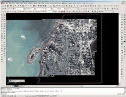
"We import that contour information into LDT and it shows us the limits of the drainage basins, the way beaches look, which areas will flood first," said Solien. "Then we superimpose our GIS parcel database on top, and it gives us a good idea of a preliminary design for hydrology."
Engineers and CADD technicians import the model into AutoCAD as a DXF file.
The county has given the LIDAR contour data to various municipalities, and ultimately plans to make it available to the public on a Web site.
"Among other uses, the model can show you what areas should be evacuated first in a hurricane," Solien said. "It has given us a head start."


