Charting a Path Toward Integrated Water Resources

Problem to be Solved
The 2013 publication Assessment of Climate Change in the Southwest US characterized the Southwestern region of the United States as one of the most “climate-challenged” in North America. Climate scientists expect water resources in this arid and semi-arid region—in many cases already stretched to the limit—to face further climate change-related stresses. Anticipated climate changes for the region include increased temperatures, decreased snowpack, more severe droughts in most of the region, and more intense precipitation events in winter. The climate assessment report, Environmental Protection Agency (EPA), and other sources have warned about some of the impacts these climate changes could have. Decreased snowpack reduces the amount of water produced in the spring, and water released from earlier snowmelt requires storage if water demands are to be met in the following year. More intense rainfall events produce more flooding. Further, such a pattern increases concentrations of pollutants in runoff from parking lots and streets that reach washes and streams. Increased heat increases evaporation as well as the water demands of plants and other living things. Humans use more energy for cooling, which translates to more water use for energy production.

The Southwest contains some of the fastest-growing cities in the United States. The Las Vegas area grew by nearly 100,000 new residents between 2011 and 2014, increasing 2.7% in just the last year, and growth is expected to continue for the foreseeable future. With a current population of 4.2 million, the Phoenix metropolitan area is the fastest-growing in the country. By 2030, the population is expected to rise to 6.3 million. With few exceptions, this growth is reflected throughout the Southwest. Much of the increase is taking place in smaller communities bordering the larger cities. For example, the growth since 2000 of the towns of Sahuarita and Marana, located outside Tucson, AZ, were 679% and 158%, respectively, significantly outpacing the average growth rate of towns in the US.

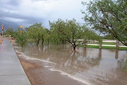
While per capita water demand has flattened and even decreased across most of the Southwest, increases in population inevitably lead to demands for more water. The Southwest’s growing population centers also result in land-use changes that increase the amount of impermeable pavement and “gray” infrastructure that shed water and create stormwater management challenges. Historically in Southwestern cities, the street system was a primary carrier of urban storm runoff, and street flooding is still common from intense rainfall events. Cities in the region can also expect an increase in the urban heat island (UHI) effect, which increases energy usage for cooling and is associated with increased threats and costs to public health and heat-related mortality. Research has shown that low-income areas disproportionately suffer from UHI-related illness and injury, making this an issue of environmental justice.

Credit: ANN AUDREY
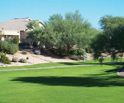
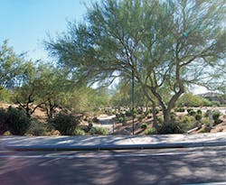
Examples of passive water harvesting installations in the Southwest

Clearly, with growing cities and a drying climate, the Southwestern region is faced with present and potential water resource challenges. These challenges are interrelated in ways that frequently can be addressed in an integrated manner when they are looked at holistically. One strategy that can integrate across challenges is water harvesting. Water harvesting, an ancient practice that has been used in many parts of the world to augment water supplies, can address not only water supply challenges, but also stormwater management, stormwater quality, energy consumption, the urban heat island effect, and more.

Water Harvesting, Green Infrastructure, and Low Impact Development
Active water harvesting strategies capture water that runs off impervious surfaces and stores it in tanks or other containers for later beneficial use. Passive water harvesting strategies shape the landscape to infiltrate water into the soil for immediate benefit. Both methods capture water as close to its source as possible. Passive practices can take place at multiple scales ranging from small residential rain gardens to microbasins in street rights of way to regional stormwater management facilities. Larger-scale applications are often termed green infrastructure (GI) or low impact development (LID), both of which denote using or mimicking natural hydrologic process and features to manage stormwater and provide environmental and community benefits. The terms GI and LID are being used more and more interchangeably to discuss approaches to managing urban stormwater runoff as a resource rather than a waste product.

Problem to be Solved The 2013 publication Assessment of Climate Change in the Southwest US characterized the Southwestern region of the United States as one of the most "climate-challenged" in North America. Climate scientists expect water resources in this arid and semi-arid region—in many cases already stretched to the limit—to face further climate change-related stresses. Anticipated climate changes for the region include increased temperatures, decreased snowpack, more severe droughts in most of the region, and more intense precipitation events in winter. The climate assessment report, Environmental Protection Agency (EPA), and other sources have warned about some of the impacts these climate changes could have. Decreased snowpack reduces the amount of water produced in the spring, and water released from earlier snowmelt requires storage if water demands are to be met in the following year. More intense rainfall events produce more flooding. Further, such a pattern increases concentrations of pollutants in runoff from parking lots and streets that reach washes and streams. Increased heat increases evaporation as well as the water demands of plants and other living things. Humans use more energy for cooling, which translates to more water use for energy production. The Southwest contains some of the fastest-growing cities in the United States. The Las Vegas area grew by nearly 100,000 new residents between 2011 and 2014, increasing 2.7% in just the last year, and growth is expected to continue for the foreseeable future. With a current population of 4.2 million, the Phoenix metropolitan area is the fastest-growing in the country. By 2030, the population is expected to rise to 6.3 million. With few exceptions, this growth is reflected throughout the Southwest. Much of the increase is taking place in smaller communities bordering the larger cities. For example, the growth since 2000 of the towns of Sahuarita and Marana, located outside Tucson, AZ, were 679% and 158%, respectively, significantly outpacing the average growth rate of towns in the US. While per capita water demand has flattened and even decreased across most of the Southwest, increases in population inevitably lead to demands for more water. The Southwest's growing population centers also result in land-use changes that increase the amount of impermeable pavement and "gray" infrastructure that shed water and create stormwater management challenges. Historically in Southwestern cities, the street system was a primary carrier of urban storm runoff, and street flooding is still common from intense rainfall events. Cities in the region can also expect an increase in the urban heat island (UHI) effect, which increases energy usage for cooling and is associated with increased threats and costs to public health and heat-related mortality. Research has shown that low-income areas disproportionately suffer from UHI-related illness and injury, making this an issue of environmental justice. [caption id="attachment_24124" align="alignright" width="300"]
Credit: ANN AUDREYExamples of passive water harvesting installations in the Southwest[/caption] Clearly, with growing cities and a drying climate, the Southwestern region is faced with present and potential water resource challenges. These challenges are interrelated in ways that frequently can be addressed in an integrated manner when they are looked at holistically. One strategy that can integrate across challenges is water harvesting. Water harvesting, an ancient practice that has been used in many parts of the world to augment water supplies, can address not only water supply challenges, but also stormwater management, stormwater quality, energy consumption, the urban heat island effect, and more. Water Harvesting, Green Infrastructure, and Low Impact Development Active water harvesting strategies capture water that runs off impervious surfaces and stores it in tanks or other containers for later beneficial use. Passive water harvesting strategies shape the landscape to infiltrate water into the soil for immediate benefit. Both methods capture water as close to its source as possible. Passive practices can take place at multiple scales ranging from small residential rain gardens to microbasins in street rights of way to regional stormwater management facilities. Larger-scale applications are often termed green infrastructure (GI) or low impact development (LID), both of which denote using or mimicking natural hydrologic process and features to manage stormwater and provide environmental and community benefits. The terms GI and LID are being used more and more interchangeably to discuss approaches to managing urban stormwater runoff as a resource rather than a waste product. [text_ad] These water harvesting approaches have several benefits. By capturing rainwater in tanks or cisterns or letting it infiltrate into the ground rather than running down driveways, roads, and other impervious surfaces, water harvesting helps mitigate flooding issues. Rainwater stored in the soil or in tanks provides an alternative to using potable water for non-potable uses, in particular watering vegetation. In arid regions of the Southwest, approximately 95% of the water that falls as rain evaporates before providing any water resource benefits. Tanks store water that would otherwise evaporate. Storing harvested water in tanks can reduce peak demand and associated needs for expanded water supply and distribution infrastructure. Vegetation supported by harvested water helps keep the urban environment green and cool. A velvet mesquite tree in Tucson, with a 20-inch-diameter trunk, can intercept almost 2,000 gallons of stormwater annually, infiltrating the runoff and using the stored water over time, reducing the need for irrigation. When used to increase urban canopy and to support strategically placed trees, water harvesting can help mitigate the urban heat island effect and reduce energy consumption through shade, evapotranspiration, and passive cooling of buildings and cars. In addition, while creating these sustainable benefits, water harvesting techniques effectively direct, infiltrate, and clean stormwater runoff. As a result, EPA has made clear that it supports and encourages the use of green infrastructure as a component of municipal separate storm sewer system (MS4s) plans. Research assessing the costs and benefits of water harvesting is only beginning to permit comparisons with other, more traditional methods, and much research remains to be done, especially in arid and semi-arid regions. However, evidence suggests that installing and maintaining these green stormwater techniques is price-competitive, or even less costly, than traditional gray infrastructure. Benefits tend to outweigh costs when viewed with a triple-bottom-line (economic, social, and environmental) analysis, especially when urban cooling is one of the project's objectives. Secondary economic benefits of water harvesting include spending on birding and other watchable wildlife activities, increased value of properties with large trees, willingness to pay higher prices in shaded shopping areas, and improved longevity of shaded pavement. [caption id="attachment_24125" align="aligncenter" width="600"]
Map showing the US boundaries of the Desert LCC and major population centers[/caption]   [caption id="attachment_24126" align="aligncenter" width="600"]
A continuum of options for implementing water harvesting[/caption] Challenges and Opportunities Because rainfall is rare and sporadic in much of the Southwestern United States, some doubt the efficacy of water harvesting. The Desert Landscape Conservation Cooperative (LCC) contains some of the most arid areas in North America. It stretches across lower portions of California, Nevada, Arizona, New Mexico, and Texas and into Northern Mexico and includes three deserts, the Mojave, Sonoran, and Chihuahuan. The Bureau of Reclamation and the US Fish and Wildlife Service have partnered to develop the Desert LCC, a bi-national, self-directed, nonregulatory regional partnership to provide support to resource managers and the broader community to address climate change and other landscape-scale ecosystem stressors. This region encompasses diverse landscapes and topography and major river systems, including the Colorado, Gila, Rio Grande, and San Pedro. While water woes make water harvesting an attractive option in this region, much of the recent research on water harvesting and green infrastructure has been conducted in more humid areas of the country, such as Philadelphia, Portland, and Chicago, which have been in the forefront when it comes to implementing these practices. Desert streams tend to be ephemeral, meaning they flow only in response to storm events. Flow events are rare and stormwater management infrastructure is designed differently for these very different climates. Dry conditions affect soil characteristics and vegetative land cover. This situation makes the application of prior experience and research results from humid areas problematic. Many important questions about the methods, cost, maintenance, and effectiveness of water harvesting in the Southwest remain unanswered. Rainfall and evapotranspiration (ET0) rates in the major population centers in the Desert LCC vary widely. El Centro, CA, at an elevation of 39 feet below sea level, receives just 2.62 inches of rain per year on average and has an ET0 of almost 80 inches per year. Flagstaff, AZ, by contrast, sits at 6,910 feet above sea level and receives more than 20 inches of rain per year. ET0 levels are much lower than in El Centro, at 47.13 inches annually. The majority of the large population centers within the LCC have annual average precipitation rates of less than 10 inches per year. By contrast, Philadelphia receives 42 inches of rainfall per year with an ET0 of 27.88. Some guidance for Southwestern communities does exist. Water harvesting manuals can provide definitions, descriptions, schematics, and examples of water harvesting features. These manuals, often produced by communities as a first step toward implementing water harvesting, provide some of the best arid-adapted examples of these practices. For communities looking for hard data on costs and benefits, more and more publications and resources are being produced by government agencies like EPA, as well as national nonprofit organizations, including American Rivers and the Center for Neighborhood Technology. Locally, groups like Tucson-based Watershed Management Group and Pima County Regional Flood Control District have focused considerable efforts on policies, manuals, and resources. Increasingly, information on the maintenance of water harvesting features is being gathered and disseminated, especially by EPA. The Desert Water Harvesting Initiative, a program developed by the Water Resources Research Center at the University of Arizona, maintains a Web-based clearinghouse providing access to these resources as they become available. However, the techniques and drivers discussed in this literature, especially in the nationally focused publications, are not always directly applicable to communities in the Desert Southwest. Relevant information can be piecemeal and difficult to assemble in a usable form. As a result, municipalities within the Desert LCC lack important guidance on how to assess water harvesting as an option for addressing water resource-related problems. Yet cities in this region have started to seriously consider water harvesting practices, and several jurisdictions within the Desert LCC have begun implementing these practices. Tucson Region's Water Harvesting History As a case study, the greater Tucson area in southeastern Arizona is broadly representative of growing cities in the Desert LCC region in the US Southwest. Tucson is a city of approximately 600,000 residents, located in a metropolitan area of smaller incorporated towns and unincorporated communities in Pima County, AZ, with a total population of just less than 1 million people. At an elevation of 2,600 feet, on average, the city encompasses 226.7 square miles within the greater region of approximately 9,000 square miles. The region receives an average of 12 inches of rain annually, falling mainly in the winter and in the summer monsoon season. Average reference ET0 is 78 inches per year. Rainwater and stormwater harvesting have long histories in Pima County. Indigenous Native American tribes have used water harvesting techniques to grow crops for centuries. For generations the Tohono O'odham tribe practiced Ak-Chin farming. This traditional farming method uses several passive techniques to irrigate plants. Farmers would plant their crops on alluvial flats to take advantage of shallow groundwater and use weirs to spread floodwaters more widely. During the summer monsoon season, water running off hillsides would be directed into irrigation ditches leading to cisterns or the root zone of trees. These traditional farming techniques, as well as wild food harvesting, are being revived today by Tohono O'odham Community Action, a community-based organization working to create a "healthy, sustainable, and culturally vital community on the Tohono O'odham Nation." The Pascua Yaqui tribe also practiced water harvesting for crop irrigation. One of their important symbols, the oppuam, represents tears, but also the rain that brings water for their crops. For many years, the Tucson region has been a leader in the effort to incorporate water harvesting into water supply and stormwater management practices. Tucson resident and grassroots activist Brad Lancaster worked with his neighbors to direct and capture rainwater through both active and passive techniques to substantially improve the streetscape of their block. They captured benefits from stormwater by cutting slots in curbs to irrigate native vegetation in the rights of way, a practice that was first discouraged and later adopted and formalized by the city. This evolution in city attitudes has turned Tucson into a model for other Southwestern cities. In 2008, Tucson became the first city in the nation to pass a commercial water harvesting ordinance. The ordinance, which went into effect in 2010, requires developers of commercial properties to meet at least 50% of their landscape irrigation needs through the use of water harvesting. Writing development standards in consultation with developers encouraged acceptance of the ordinance. To promote household-scale water harvesting, the city's water utility administers a rebate program that reimburses a portion of the costs residents incur for implementing water harvesting at their homes. To ensure proper implementation, the program requires applicants to attend a free three-hour training session. Tucson's transportation department adopted a Green Streets policy to use stormwater runoff in medians and roadsides to irrigate vegetation in new road construction and major road reconstruction. [caption id="attachment_24127" align="alignleft" width="300"]
Credit: J. BECKER PIMA COUNTY REGIONAL FLOOD CONTROL DISTRICTEd Pastor Kino Environmental Restoration Project[/caption] The Ed Pastor Kino Environmental Restoration Project (KERP) is an example of a large-scale water harvesting installation. A joint effort by the US Army Corps of Engineers and Pima County, the project involved the reconstruction of a regional flood control detention basin to incorporate urban stormwater harvesting into a multiuse recreational facility and wetlands. The 125-acre KERP facility detains and can store up to 1,880 acre-feet of stormwater. Harvested water is used for irrigating the Kino Sports Complex ballpark, athletic fields, landscaping, and the facility's hydro-riparian native vegetation, saving the complex hundreds of thousands of dollars in water costs and transforming it into a popular bird-watching attraction. Experience in Tucson demonstrates that even with scarce rainfall, water harvesting can successfully reap multiple benefits. The Water Harvesting Toolbox Even communities convinced of the value of water harvesting still must assess its use to address specific sets of issues, making decisions about the most appropriate scale of projects, the land-use sectors that are the best targets for water harvesting solutions, and the implementation steps needed to achieve water harvesting goals. Starting from Tucson's experiences with water harvesting, a decision support toolbox was created that promotes the appropriate use of water harvesting to achieve benefits desired by Desert LCC municipalities. The Water Harvesting Assessment Toolbox (WHAT) is a prototype decision aid designed to help communities in the US Southwest assess the feasibility of employing defined water harvesting practices and empower them to make decisions regarding water management infrastructure that give adequate consideration to green alternatives such as water harvesting. The WHAT is intended for use by a wide range of water resource decision-makers and professional staff. The assessment process enables users to identify and address water challenges in the community from the perspectives of multiple municipal departments. It was intended to be used at the local scale and to be generally applicable to localities within the Desert LCC region. It is useful to communities facing a complex set of challenges that can be addressed in an integrated fashion through water harvesting. [caption id="attachment_24128" align="alignright" width="300"]
Credit: ANN AUDREY AND WRCCExample of passive water harvesting installations in the Southwest[/caption] Toolbox Description and Use. Use of the WHAT is carried out with the assistance of a facilitator who oversees the assessment process and utilization of the five tools provided with the toolbox. Step-by-step instructions for facilitators are provided in a detailed facilitator instructions document. During the assessment process, users identify local water resource challenges, evaluate land-use sectors with water harvesting potential, understand water harvesting benefits and strategies, prioritize water harvesting approaches, estimate water harvesting potential relative to plant water demands, learn important design guidelines, and become familiar with the key implementation steps that may be appropriate to their circumstances. Tool 1: Water Harvesting Assessment Presentation. The video presentation entitled "Guide to Assessing Rainwater and Stormwater Harvesting Potential" is a narrated, 95-slide, 54-minute video that leads users from general orientation to water harvesting strategies and techniques to specific water harvesting implementation options. The presentation is filled with visually appealing examples of water harvesting practices in arid and semi-arid environments and prompts periodic discussions and real-time analysis of local water harvesting potential using the Tool 2 and Tool 3 spreadsheets. The final section of the narrated video guide lays out strategies for implementation of water harvesting practices. [caption id="attachment_24129" align="alignleft" width="300"]
Credit: ANN AUDREY AND WRCCExample of passive water harvesting installations in the Southwest[/caption] Tool 2: Water Harvesting Assessment Spreadsheet. The toolbox includes worksheets to support consensus building. At intervals in the narrated slide show, the facilitator pauses the video for discussion among the participants regarding local challenges and priorities. Results of these discussions are recorded on the worksheets, and the facilitator enters the consensus onto spreadsheets that calculate and display in graphic form where and how participants think water harvesting will produce the benefits their community values. Representatives of the community of Sahuarita, AZ, for example, rallied around the idea of creating a project at the town office complex for public education and a demonstration of community commitment to water harvesting. Tool 3: Catchment-to-Canopy-Area Ratio Spreadsheet. This Excel spreadsheet assists users in determining the optimum ratio of water harvesting catchment area to plant-canopy area to meet plant water needs in their location. Rainfall, evapotranspiration, and plant water demand data are provided within the spreadsheet for the large population centers within the Desert LCC. The spreadsheet can be used for other geographic areas by inserting location-specific data. Tool 4: Water Harvesting Resources. This website hosts links to numerous resources and in-depth information about the water harvesting topics introduced in Tool 1. These resources are accessed by clicking on numbered orange circles displayed on the slides. Further water harvesting resources are available through the Desert Water Harvesting Initiative homepage. Tool 5: Decision-Maker Presentation Template. This customizable 20-slide PowerPoint presentation allows users to insert their own site-specific water harvesting assessment results, graphs, photographs, and recommendations to create a concise and effective presentation for decision-makers and the public. [caption id="attachment_24131" align="alignright" width="300"]
Credit: ANN AUDREYMultifamily and subdivision common area landusesector with water harvesting potential.[/caption] Designing the WHAT Input from several utilities and water resource-related groups in southern Arizona informed toolbox development. The Arizona Municipal Water Users Association (AMWUA) in Phoenix, AZ, is a group consisting of representatives from Phoenix-area cities. Meetings are attended most frequently by conservation or sustainability staff. At an AMWUA meeting to discuss the WHAT concept, participants articulated the need to have representatives of multiple departments in any discussion of water harvesting because, in many cases, the conservation officers are already convinced of water harvesting's efficacy. In the toolbox process, a municipality is best represented by its major departments: water utility, flood control agency, transportation department, planning department, energy utility, homeowners' association representatives, builders, conservation and sustainability offices, and all others who deal with water, energy, economics, and livability. The town of Oro Valley, AZ, has both a water department and stormwater utility and has taken several steps to implement water harvesting in the town, including incorporating water harvesting into a landscape code update. This update includes language that sets maximum limits on the amount of irrigation applied to landscapes and requires the elimination of all irrigation, after a five-year establishment period, on certain types of landscapes such as buffer areas and road medians. Water harvesting practices can help direct water to these areas without relying on irrigation. Despite Oro Valley's progress, however, homeowners' associations push back against allowing water harvesting within their neighborhoods because they associate water harvesting with large corrugated metal cisterns. Staff members in Oro Valley emphasized the need to expose users to a variety of images of water harvesting to illustrate the fact that these practices go far beyond metal cisterns and that passive techniques, when done well, can be almost invisible. [caption id="attachment_24132" align="alignleft" width="300"]
Credit: ANN AUDREYStreet right-of-way[/caption] The Metropolitan Domestic Water Improvement District (Metro Water) is a small water provider to various unincorporated areas near Tucson. Metro Water is an example of a water utility without stormwater responsibilities, and without the ability to integrate benefits across multiple departments in the way a municipality can. The recent economic recession reduced the amount of water the district's customers are using. This reduced Metro Water's financial ability to maintain its primary activities, let alone support water harvesting programs such as large rebates for system installations. This underlined the need to approach water harvesting as a means for achieving multiple benefits rather than looking only at water conservation benefits. Discussion with Metro Water staff also revealed that although managers and staff of a utility may support water harvesting, higher-level decision-makers must also be convinced of the effectiveness of these techniques before implementation can begin. Thus communication between advocates and decision-makers needs to be supported by evidence from a careful assessment that clearly articulates water harvesting's multiple benefits to the community. The Surface Water Working Group (SWWG) at the University of Arizona (UA), consisting of professors, students, maintenance staff, and campus planners, works to solve campus flooding issues in a sustainable way. As a result of their work, the UA campus features many examples of water harvesting practices, both active and passive. Members of the group emphasized the need to assess the multiple benefits of water harvesting to support adoption, pointing to the university's own history as an example. Water harvesting on the university campus did not originate as a way to conserve potable water, despite the significant water requirements of the large and well-landscaped grounds. Instead, campus planners installed water harvesting features to prevent stormwater runoff from leaving campus boundaries and flooding surrounding neighborhoods. In fact, water harvesting projects have not yet affected water use for irrigation on campus. This may be changing, however. The major driver for implementing water harvesting at the university now is the desire of prospective students for "green" features on campus. A university Green Fund provides financial support for projects, which have included rainwater harvesting installations on numerous sites. A water harvesting class is offered each year in which students develop practical water harvesting solutions that have been implemented, both on campus and off campus. [caption id="attachment_24133" align="alignright" width="300"]
Credit: ANN AUDREYSingle-family residential unit[/caption] Community Responses Three municipalities in southern Arizona provided a series of "test drives" of the WHAT during development: Marana, Sahuarita, and Sierra Vista. The town of Clarkdale in north-central Arizona tested the final toolbox. The town of Marana, located northwest of Tucson, has grown rapidly in recent years. Primarily an agricultural center for many decades, the town now spans more than 120 square miles and has a population of 35,000. Staff members representing many municipal departments, including utilities, development engineering, development services, environmental engineering, economic development, planning, and public works, participated in discussion of a wide range of issues regarding the application of water harvesting practices. There was a general feeling that the town had already reached a supply-demand pinch point with the growth in population, and water harvesting could lessen the need to constantly search out new water supplies. Water harvesting could also solve problems such as mitigating the need to repair roads after flooding. Passive water harvesting installed in arid landscapes was a more appealing approach for the community than cisterns, partly because of the long payback period for tanks. Concerns raised included the risk to infrastructure from saturating soils next to roadways and the design of vegetated retention basins that also act as drainage ways. An "executive-style" summary to take to mayor and council, one that would give the "30,000-foot view," was decidedly a useful tool, especially when it could include data on costs and benefits. Sahuarita lies 15 miles south of Tucson and is home to Rancho Sahuarita, a master-planned community, as well as the largest irrigated pecan orchard in the world. Like Marana, Sahuarita has experienced high levels of population growth. Representatives of the town's public works, planning and zoning and parks and recreation departments, as well as staff members of the Freeport-McMoRan Sierrita mining company, discussed concerns about the cost and quality of potential new water sources needed to keep up with future population growth. In addition, they expressed the desire to avoid "pour[ing] money into the ground" by putting in new storm drains. At the same time, they acknowledged that Sahuarita's mayor and council have billed themselves as business-friendly and do not want to overburden developers. A shift in thinking from shedding stormwater to putting it to beneficial use and viewing water harvesting as a cost saver, not a cost burden, could help overcome reluctance of the development community to support water harvesting. They emphasized the practicality of water harvesting and its potential to reduce upfront infrastructure costs as well as ongoing maintenance as compared with storm drains and other engineered improvements. The city of Sierra Vista, located 75 miles southeast of Tucson in Cochise County, has a population of more than 45,000 and includes the Ft. Huachuca Army post, a major economic driver in the region. The city is also experiencing rapid population growth, and its close proximity to the San Pedro River, a biologically important migratory bird stopover and critical habitat for several endangered species, has led to tension regarding groundwater use. Reflecting the number of interested and involved parties in the area, representatives from the city of Sierra Vista, Cochise County, the University of Arizona Cochise County Cooperative Extension's WaterWise program, the nonprofit Western Resource Advocates, and homebuilder Castle and Cooke participated. They were most concerned with the need to reduce the amount of groundwater used in the area as quickly as possible to protect the San Pedro River and avoid negative consequences for Ft. Huachuca. They also raised concerns regarding the rising cost of meeting EPA requirements for stormwater pollution prevention. Despite perceived barriers to water harvesting, which included code conflicts, water pricing that does little to encourage conservation, and a very transient military population, water harvesting can help the community achieve water resource goals. Passive water harvesting in new developments, especially in common areas, works without residents knowing about it, if installed correctly, and developers will be on board as long as the "dollar side" makes sense. Clarkdale, a small town in the Verde River Valley with a population of approximately 4,100 people, was the location for the first full-scale application of the final WHAT products. At an elevation of 3,546 feet, Clarkdale has an average rainfall of 13 inches per year, with the highest quantity of precipitation falling in August. ET0 for the Verde Valley region is estimated at 47 inches annually. On a regional scale, it is recognized that there will be problems with water supply as climate change and population growth challenge the precarious balance of groundwater extraction and natural recharge. Groundwater levels already show some declines. A diverse group attended the WHAT session, including Clarkdale's town manager, planning technician, public works supervisor, and community and development director, as well as a local real estate developer. Also present were representatives from three neighboring communities, the town of Camp Verde and the cities of Sedona and Cottonwood. The discussions prompted by the Tool 1 presentation illustrated how unique and site-specific water demand, challenges, and opportunities can be. Challenges, opportunities, and priorities were perceived very differently among the four represented communities. The town of Clarkdale already has very low gallons-per-capita-per-day (GPCD) usage at 70 GPCD. The recent reduction in per capita use was driven by substantially increased water rates after the town purchased the private water utility. The Clarkdale participants believed that their citizens have a high level of awareness about their water issues. The town also has A+ effluent from a new water treatment plant and has yet to it put to beneficial use. Its current challenges, though not insurmountable, are managing supplies to meet peak demand and managing stormwater volume. Participants could envision ordinances and specifications being passed in the future for new residential developments to implement passive water harvesting, particularly in common areas, for multiple purposes. Their current development design, however, makes retrofits of rainwater harvesting at the residential scale problematic. The town recently installed a very visible demonstration site, capturing rainwater from the roof and the parking lot of the town hall through use of an underground tank, curb cuts, basins, swales, and low-water-use native vegetation. Made possible through grant funding, this demonstration project has received a positive response from local residents. Conclusion Water harvesting has multiple benefits for communities. Guidance on water harvesting for communities in the arid/semi-arid Southwest is relatively scarce. This and other impediments to implementing water harvesting limit its adoption despite the many water resource challenges these communities face. The WHAT, which is free online to any user with an Internet connection, provides specific guidance to Desert LCC communities, stepping users through a process from identification of water harvesting potential through implementation planning. Test drives in Arizona communities demonstrated the effectiveness of the tools in the toolbox in generating discussion among departments within a jurisdiction and educating representatives about the benefits of water harvesting. As described above, these include augmenting water supply, cleaning stormwater runoff through infiltration and bioremediation, reducing flood volume, and greening of the urban environment. The WHAT provides easily accessible decision support for Southwestern communities, large and small, investigating water harvesting as a component of their water resource management portfolio. 
These water harvesting approaches have several benefits. By capturing rainwater in tanks or cisterns or letting it infiltrate into the ground rather than running down driveways, roads, and other impervious surfaces, water harvesting helps mitigate flooding issues. Rainwater stored in the soil or in tanks provides an alternative to using potable water for non-potable uses, in particular watering vegetation. In arid regions of the Southwest, approximately 95% of the water that falls as rain evaporates before providing any water resource benefits. Tanks store water that would otherwise evaporate. Storing harvested water in tanks can reduce peak demand and associated needs for expanded water supply and distribution infrastructure. Vegetation supported by harvested water helps keep the urban environment green and cool. A velvet mesquite tree in Tucson, with a 20-inch-diameter trunk, can intercept almost 2,000 gallons of stormwater annually, infiltrating the runoff and using the stored water over time, reducing the need for irrigation. When used to increase urban canopy and to support strategically placed trees, water harvesting can help mitigate the urban heat island effect and reduce energy consumption through shade, evapotranspiration, and passive cooling of buildings and cars. In addition, while creating these sustainable benefits, water harvesting techniques effectively direct, infiltrate, and clean stormwater runoff. As a result, EPA has made clear that it supports and encourages the use of green infrastructure as a component of municipal separate storm sewer system (MS4s) plans.

Research assessing the costs and benefits of water harvesting is only beginning to permit comparisons with other, more traditional methods, and much research remains to be done, especially in arid and semi-arid regions. However, evidence suggests that installing and maintaining these green stormwater techniques is price-competitive, or even less costly, than traditional gray infrastructure. Benefits tend to outweigh costs when viewed with a triple-bottom-line (economic, social, and environmental) analysis, especially when urban cooling is one of the project’s objectives. Secondary economic benefits of water harvesting include spending on birding and other watchable wildlife activities, increased value of properties with large trees, willingness to pay higher prices in shaded shopping areas, and improved longevity of shaded pavement.

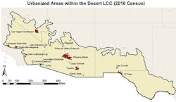
Map showing the US boundaries of the Desert LCC and major population centers
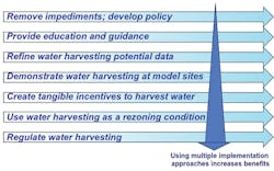
A continuum of options for implementing water harvesting

Challenges and Opportunities
Because rainfall is rare and sporadic in much of the Southwestern United States, some doubt the efficacy of water harvesting. The Desert Landscape Conservation Cooperative (LCC) contains some of the most arid areas in North America. It stretches across lower portions of California, Nevada, Arizona, New Mexico, and Texas and into Northern Mexico and includes three deserts, the Mojave, Sonoran, and Chihuahuan. The Bureau of Reclamation and the US Fish and Wildlife Service have partnered to develop the Desert LCC, a bi-national, self-directed, nonregulatory regional partnership to provide support to resource managers and the broader community to address climate change and other landscape-scale ecosystem stressors. This region encompasses diverse landscapes and topography and major river systems, including the Colorado, Gila, Rio Grande, and San Pedro.

While water woes make water harvesting an attractive option in this region, much of the recent research on water harvesting and green infrastructure has been conducted in more humid areas of the country, such as Philadelphia, Portland, and Chicago, which have been in the forefront when it comes to implementing these practices. Desert streams tend to be ephemeral, meaning they flow only in response to storm events. Flow events are rare and stormwater management infrastructure is designed differently for these very different climates. Dry conditions affect soil characteristics and vegetative land cover. This situation makes the application of prior experience and research results from humid areas problematic. Many important questions about the methods, cost, maintenance, and effectiveness of water harvesting in the Southwest remain unanswered.

Rainfall and evapotranspiration (ET0) rates in the major population centers in the Desert LCC vary widely. El Centro, CA, at an elevation of 39 feet below sea level, receives just 2.62 inches of rain per year on average and has an ET0 of almost 80 inches per year. Flagstaff, AZ, by contrast, sits at 6,910 feet above sea level and receives more than 20 inches of rain per year. ET0 levels are much lower than in El Centro, at 47.13 inches annually. The majority of the large population centers within the LCC have annual average precipitation rates of less than 10 inches per year. By contrast, Philadelphia receives 42 inches of rainfall per year with an ET0 of 27.88.

Some guidance for Southwestern communities does exist. Water harvesting manuals can provide definitions, descriptions, schematics, and examples of water harvesting features. These manuals, often produced by communities as a first step toward implementing water harvesting, provide some of the best arid-adapted examples of these practices. For communities looking for hard data on costs and benefits, more and more publications and resources are being produced by government agencies like EPA, as well as national nonprofit organizations, including American Rivers and the Center for Neighborhood Technology. Locally, groups like Tucson-based Watershed Management Group and Pima County Regional Flood Control District have focused considerable efforts on policies, manuals, and resources. Increasingly, information on the maintenance of water harvesting features is being gathered and disseminated, especially by EPA. The Desert Water Harvesting Initiative, a program developed by the Water Resources Research Center at the University of Arizona, maintains a Web-based clearinghouse providing access to these resources as they become available.

However, the techniques and drivers discussed in this literature, especially in the nationally focused publications, are not always directly applicable to communities in the Desert Southwest. Relevant information can be piecemeal and difficult to assemble in a usable form. As a result, municipalities within the Desert LCC lack important guidance on how to assess water harvesting as an option for addressing water resource-related problems. Yet cities in this region have started to seriously consider water harvesting practices, and several jurisdictions within the Desert LCC have begun implementing these practices.

Tucson Region’s Water Harvesting History
As a case study, the greater Tucson area in southeastern Arizona is broadly representative of growing cities in the Desert LCC region in the US Southwest. Tucson is a city of approximately 600,000 residents, located in a metropolitan area of smaller incorporated towns and unincorporated communities in Pima County, AZ, with a total population of just less than 1 million people. At an elevation of 2,600 feet, on average, the city encompasses 226.7 square miles within the greater region of approximately 9,000 square miles. The region receives an average of 12 inches of rain annually, falling mainly in the winter and in the summer monsoon season. Average reference ET0 is 78 inches per year.

Rainwater and stormwater harvesting have long histories in Pima County. Indigenous Native American tribes have used water harvesting techniques to grow crops for centuries. For generations the Tohono O’odham tribe practiced Ak-Chin farming. This traditional farming method uses several passive techniques to irrigate plants. Farmers would plant their crops on alluvial flats to take advantage of shallow groundwater and use weirs to spread floodwaters more widely. During the summer monsoon season, water running off hillsides would be directed into irrigation ditches leading to cisterns or the root zone of trees. These traditional farming techniques, as well as wild food harvesting, are being revived today by Tohono O’odham Community Action, a community-based organization working to create a “healthy, sustainable, and culturally vital community on the Tohono O’odham Nation.” The Pascua Yaqui tribe also practiced water harvesting for crop irrigation. One of their important symbols, the oppuam, represents tears, but also the rain that brings water for their crops.

For many years, the Tucson region has been a leader in the effort to incorporate water harvesting into water supply and stormwater management practices. Tucson resident and grassroots activist Brad Lancaster worked with his neighbors to direct and capture rainwater through both active and passive techniques to substantially improve the streetscape of their block. They captured benefits from stormwater by cutting slots in curbs to irrigate native vegetation in the rights of way, a practice that was first discouraged and later adopted and formalized by the city. This evolution in city attitudes has turned Tucson into a model for other Southwestern cities.

In 2008, Tucson became the first city in the nation to pass a commercial water harvesting ordinance. The ordinance, which went into effect in 2010, requires developers of commercial properties to meet at least 50% of their landscape irrigation needs through the use of water harvesting. Writing development standards in consultation with developers encouraged acceptance of the ordinance. To promote household-scale water harvesting, the city’s water utility administers a rebate program that reimburses a portion of the costs residents incur for implementing water harvesting at their homes. To ensure proper implementation, the program requires applicants to attend a free three-hour training session. Tucson’s transportation department adopted a Green Streets policy to use stormwater runoff in medians and roadsides to irrigate vegetation in new road construction and major road reconstruction.

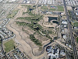
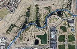
Credit: J. BECKER PIMA COUNTY REGIONAL FLOOD CONTROL DISTRICT
Ed Pastor Kino Environmental Restoration Project

The Ed Pastor Kino Environmental Restoration Project (KERP) is an example of a large-scale water harvesting installation. A joint effort by the US Army Corps of Engineers and Pima County, the project involved the reconstruction of a regional flood control detention basin to incorporate urban stormwater harvesting into a multiuse recreational facility and wetlands. The 125-acre KERP facility detains and can store up to 1,880 acre-feet of stormwater. Harvested water is used for irrigating the Kino Sports Complex ballpark, athletic fields, landscaping, and the facility’s hydro-riparian native vegetation, saving the complex hundreds of thousands of dollars in water costs and transforming it into a popular bird-watching attraction. Experience in Tucson demonstrates that even with scarce rainfall, water harvesting can successfully reap multiple benefits.

The Water Harvesting Toolbox
Even communities convinced of the value of water harvesting still must assess its use to address specific sets of issues, making decisions about the most appropriate scale of projects, the land-use sectors that are the best targets for water harvesting solutions, and the implementation steps needed to achieve water harvesting goals. Starting from Tucson’s experiences with water harvesting, a decision support toolbox was created that promotes the appropriate use of water harvesting to achieve benefits desired by Desert LCC municipalities. The Water Harvesting Assessment Toolbox (WHAT) is a prototype decision aid designed to help communities in the US Southwest assess the feasibility of employing defined water harvesting practices and empower them to make decisions regarding water management infrastructure that give adequate consideration to green alternatives such as water harvesting.

The WHAT is intended for use by a wide range of water resource decision-makers and professional staff. The assessment process enables users to identify and address water challenges in the community from the perspectives of multiple municipal departments. It was intended to be used at the local scale and to be generally applicable to localities within the Desert LCC region. It is useful to communities facing a complex set of challenges that can be addressed in an integrated fashion through water harvesting.

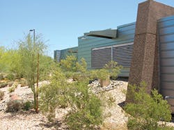
Credit: ANN AUDREY AND WRCC
Example of passive water harvesting installations in the Southwest

Toolbox Description and Use. Use of the WHAT is carried out with the assistance of a facilitator who oversees the assessment process and utilization of the five tools provided with the toolbox. Step-by-step instructions for facilitators are provided in a detailed facilitator instructions document. During the assessment process, users identify local water resource challenges, evaluate land-use sectors with water harvesting potential, understand water harvesting benefits and strategies, prioritize water harvesting approaches, estimate water harvesting potential relative to plant water demands, learn important design guidelines, and become familiar with the key implementation steps that may be appropriate to their circumstances.

Tool 1: Water Harvesting Assessment Presentation. The video presentation entitled “Guide to Assessing Rainwater and Stormwater Harvesting Potential” is a narrated, 95-slide, 54-minute video that leads users from general orientation to water harvesting strategies and techniques to specific water harvesting implementation options. The presentation is filled with visually appealing examples of water harvesting practices in arid and semi-arid environments and prompts periodic discussions and real-time analysis of local water harvesting potential using the Tool 2 and Tool 3 spreadsheets. The final section of the narrated video guide lays out strategies for implementation of water harvesting practices.

Credit: ANN AUDREY AND WRCC
Example of passive water harvesting installations in the Southwest

Tool 2: Water Harvesting Assessment Spreadsheet. The toolbox includes worksheets to support consensus building. At intervals in the narrated slide show, the facilitator pauses the video for discussion among the participants regarding local challenges and priorities. Results of these discussions are recorded on the worksheets, and the facilitator enters the consensus onto spreadsheets that calculate and display in graphic form where and how participants think water harvesting will produce the benefits their community values. Representatives of the community of Sahuarita, AZ, for example, rallied around the idea of creating a project at the town office complex for public education and a demonstration of community commitment to water harvesting.

Tool 3: Catchment-to-Canopy-Area Ratio Spreadsheet. This Excel spreadsheet assists users in determining the optimum ratio of water harvesting catchment area to plant-canopy area to meet plant water needs in their location. Rainfall, evapotranspiration, and plant water demand data are provided within the spreadsheet for the large population centers within the Desert LCC. The spreadsheet can be used for other geographic areas by inserting location-specific data.

Tool 4: Water Harvesting Resources. This website hosts links to numerous resources and in-depth information about the water harvesting topics introduced in Tool 1. These resources are accessed by clicking on numbered orange circles displayed on the slides. Further water harvesting resources are available through the Desert Water Harvesting Initiative homepage.

Tool 5: Decision-Maker Presentation Template. This customizable 20-slide PowerPoint presentation allows users to insert their own site-specific water harvesting assessment results, graphs, photographs, and recommendations to create a concise and effective presentation for decision-makers and the public.

Credit: ANN AUDREY
Multifamily and subdivision common area landuse
sector with water harvesting potential.

Designing the WHAT
Input from several utilities and water resource-related groups in southern Arizona informed toolbox development.

The Arizona Municipal Water Users Association (AMWUA) in Phoenix, AZ, is a group consisting of representatives from Phoenix-area cities. Meetings are attended most frequently by conservation or sustainability staff. At an AMWUA meeting to discuss the WHAT concept, participants articulated the need to have representatives of multiple departments in any discussion of water harvesting because, in many cases, the conservation officers are already convinced of water harvesting’s efficacy. In the toolbox process, a municipality is best represented by its major departments: water utility, flood control agency, transportation department, planning department, energy utility, homeowners’ association representatives, builders, conservation and sustainability offices, and all others who deal with water, energy, economics, and livability.

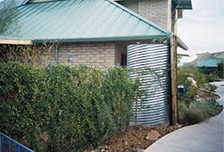
The town of Oro Valley, AZ, has both a water department and stormwater utility and has taken several steps to implement water harvesting in the town, including incorporating water harvesting into a landscape code update. This update includes language that sets maximum limits on the amount of irrigation applied to landscapes and requires the elimination of all irrigation, after a five-year establishment period, on certain types of landscapes such as buffer areas and road medians. Water harvesting practices can help direct water to these areas without relying on irrigation. Despite Oro Valley’s progress, however, homeowners’ associations push back against allowing water harvesting within their neighborhoods because they associate water harvesting with large corrugated metal cisterns. Staff members in Oro Valley emphasized the need to expose users to a variety of images of water harvesting to illustrate the fact that these practices go far beyond metal cisterns and that passive techniques, when done well, can be almost invisible.

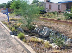
Credit: ANN AUDREY
Street right-of-way

The Metropolitan Domestic Water Improvement District (Metro Water) is a small water provider to various unincorporated areas near Tucson. Metro Water is an example of a water utility without stormwater responsibilities, and without the ability to integrate benefits across multiple departments in the way a municipality can. The recent economic recession reduced the amount of water the district’s customers are using. This reduced Metro Water’s financial ability to maintain its primary activities, let alone support water harvesting programs such as large rebates for system installations. This underlined the need to approach water harvesting as a means for achieving multiple benefits rather than looking only at water conservation benefits. Discussion with Metro Water staff also revealed that although managers and staff of a utility may support water harvesting, higher-level decision-makers must also be convinced of the effectiveness of these techniques before implementation can begin. Thus communication between advocates and decision-makers needs to be supported by evidence from a careful assessment that clearly articulates water harvesting’s multiple benefits to the community.

The Surface Water Working Group (SWWG) at the University of Arizona (UA), consisting of professors, students, maintenance staff, and campus planners, works to solve campus flooding issues in a sustainable way. As a result of their work, the UA campus features many examples of water harvesting practices, both active and passive. Members of the group emphasized the need to assess the multiple benefits of water harvesting to support adoption, pointing to the university’s own history as an example. Water harvesting on the university campus did not originate as a way to conserve potable water, despite the significant water requirements of the large and well-landscaped grounds. Instead, campus planners installed water harvesting features to prevent stormwater runoff from leaving campus boundaries and flooding surrounding neighborhoods. In fact, water harvesting projects have not yet affected water use for irrigation on campus. This may be changing, however. The major driver for implementing water harvesting at the university now is the desire of prospective students for “green” features on campus. A university Green Fund provides financial support for projects, which have included rainwater harvesting installations on numerous sites. A water harvesting class is offered each year in which students develop practical water harvesting solutions that have been implemented, both on campus and off campus.

Credit: ANN AUDREY
Single-family residential unit

Community Responses
Three municipalities in southern Arizona provided a series of “test drives” of the WHAT during development: Marana, Sahuarita, and Sierra Vista. The town of Clarkdale in north-central Arizona tested the final toolbox.

The town of Marana, located northwest of Tucson, has grown rapidly in recent years. Primarily an agricultural center for many decades, the town now spans more than 120 square miles and has a population of 35,000. Staff members representing many municipal departments, including utilities, development engineering, development services, environmental engineering, economic development, planning, and public works, participated in discussion of a wide range of issues regarding the application of water harvesting practices. There was a general feeling that the town had already reached a supply-demand pinch point with the growth in population, and water harvesting could lessen the need to constantly search out new water supplies. Water harvesting could also solve problems such as mitigating the need to repair roads after flooding. Passive water harvesting installed in arid landscapes was a more appealing approach for the community than cisterns, partly because of the long payback period for tanks. Concerns raised included the risk to infrastructure from saturating soils next to roadways and the design of vegetated retention basins that also act as drainage ways. An “executive-style” summary to take to mayor and council, one that would give the “30,000-foot view,” was decidedly a useful tool, especially when it could include data on costs and benefits.

Sahuarita lies 15 miles south of Tucson and is home to Rancho Sahuarita, a master-planned community, as well as the largest irrigated pecan orchard in the world. Like Marana, Sahuarita has experienced high levels of population growth. Representatives of the town’s public works, planning and zoning and parks and recreation departments, as well as staff members of the Freeport-McMoRan Sierrita mining company, discussed concerns about the cost and quality of potential new water sources needed to keep up with future population growth. In addition, they expressed the desire to avoid “pour[ing] money into the ground” by putting in new storm drains. At the same time, they acknowledged that Sahuarita’s mayor and council have billed themselves as business-friendly and do not want to overburden developers. A shift in thinking from shedding stormwater to putting it to beneficial use and viewing water harvesting as a cost saver, not a cost burden, could help overcome reluctance of the development community to support water harvesting. They emphasized the practicality of water harvesting and its potential to reduce upfront infrastructure costs as well as ongoing maintenance as compared with storm drains and other engineered improvements.

The city of Sierra Vista, located 75 miles southeast of Tucson in Cochise County, has a population of more than 45,000 and includes the Ft. Huachuca Army post, a major economic driver in the region. The city is also experiencing rapid population growth, and its close proximity to the San Pedro River, a biologically important migratory bird stopover and critical habitat for several endangered species, has led to tension regarding groundwater use. Reflecting the number of interested and involved parties in the area, representatives from the city of Sierra Vista, Cochise County, the University of Arizona Cochise County Cooperative Extension’s WaterWise program, the nonprofit Western Resource Advocates, and homebuilder Castle and Cooke participated. They were most concerned with the need to reduce the amount of groundwater used in the area as quickly as possible to protect the San Pedro River and avoid negative consequences for Ft. Huachuca. They also raised concerns regarding the rising cost of meeting EPA requirements for stormwater pollution prevention. Despite perceived barriers to water harvesting, which included code conflicts, water pricing that does little to encourage conservation, and a very transient military population, water harvesting can help the community achieve water resource goals. Passive water harvesting in new developments, especially in common areas, works without residents knowing about it, if installed correctly, and developers will be on board as long as the “dollar side” makes sense.

Clarkdale, a small town in the Verde River Valley with a population of approximately 4,100 people, was the location for the first full-scale application of the final WHAT products. At an elevation of 3,546 feet, Clarkdale has an average rainfall of 13 inches per year, with the highest quantity of precipitation falling in August. ET0 for the Verde Valley region is estimated at 47 inches annually. On a regional scale, it is recognized that there will be problems with water supply as climate change and population growth challenge the precarious balance of groundwater extraction and natural recharge. Groundwater levels already show some declines.

A diverse group attended the WHAT session, including Clarkdale’s town manager, planning technician, public works supervisor, and community and development director, as well as a local real estate developer. Also present were representatives from three neighboring communities, the town of Camp Verde and the cities of Sedona and Cottonwood. The discussions prompted by the Tool 1 presentation illustrated how unique and site-specific water demand, challenges, and opportunities can be. Challenges, opportunities, and priorities were perceived very differently among the four represented communities.

The town of Clarkdale already has very low gallons-per-capita-per-day (GPCD) usage at 70 GPCD. The recent reduction in per capita use was driven by substantially increased water rates after the town purchased the private water utility. The Clarkdale participants believed that their citizens have a high level of awareness about their water issues. The town also has A+ effluent from a new water treatment plant and has yet to it put to beneficial use. Its current challenges, though not insurmountable, are managing supplies to meet peak demand and managing stormwater volume. Participants could envision ordinances and specifications being passed in the future for new residential developments to implement passive water harvesting, particularly in common areas, for multiple purposes. Their current development design, however, makes retrofits of rainwater harvesting at the residential scale problematic. The town recently installed a very visible demonstration site, capturing rainwater from the roof and the parking lot of the town hall through use of an underground tank, curb cuts, basins, swales, and low-water-use native vegetation. Made possible through grant funding, this demonstration project has received a positive response from local residents.

Conclusion Water harvesting has multiple benefits for communities. Guidance on water harvesting for communities in the arid/semi-arid Southwest is relatively scarce. This and other impediments to implementing water harvesting limit its adoption despite the many water resource challenges these communities face. The WHAT, which is free online to any user with an Internet connection, provides specific guidance to Desert LCC communities, stepping users through a process from identification of water harvesting potential through implementation planning. Test drives in Arizona communities demonstrated the effectiveness of the tools in the toolbox in generating discussion among departments within a jurisdiction and educating representatives about the benefits of water harvesting. As described above, these include augmenting water supply, cleaning stormwater runoff through infiltration and bioremediation, reducing flood volume, and greening of the urban environment. The WHAT provides easily accessible decision support for Southwestern communities, large and small, investigating water harvesting as a component of their water resource management portfolio. 
About the Author

Jenna Cleveland, Susanna Eden, Jackie Moxley, Ann Audrey

Jenna Cleveland is a consulting associate; Susanna Eden and Jackie Moxley are with the University of Arizona Water Resources Research Center; and Ann Audrey is a consultant.

Sponsored Recommendations

ArmorBlock 5000: Boost Automation Efficiency

April 25, 2024
Discover the transformative benefits of leveraging a scalable On-Machine I/O to improve flexibility, enhance reliability and streamline operations.

Rising Cyber Threats and the Impact on Risk and Resiliency Operations

April 25, 2024
The world of manufacturing is changing, and Generative AI is one of the many change agents. The 2024 State of Smart Manufacturing Report takes a deep dive into how Generative ...

State of Smart Manufacturing Report Series

April 25, 2024
The world of manufacturing is changing, and Generative AI is one of the many change agents. The 2024 State of Smart Manufacturing Report takes a deep dive into how Generative ...

SmartSights WIN-911 Alarm Notification Software Enables Faster Response

March 15, 2024
Alarm notification software enables faster response for customers, keeping production on track