Staying Ahead Of The Game
Integrated forecasting software can now accurately forecast water level, flood depth and sea state for the days ahead. Richard Body discusses how such tools helped predict flooding in Egypt and are helping to make water resource management more efficient in Thailand.
There is often a gap between computer modeling of flooding events and their application to the real world. Continued evolution of software, telemetry, and related technologies is removing this gap and giving municipal planners and floodplain managers the real tools to eliminate loss of life and minimise damage.
The trend for water systems throughout the world is leaning towards more holistic approaches to water resource planning and management – floodplain management is no exception. Enhanced protection flooding is a good example of where the integrated approach can pay significant dividends. Economic and to a lesser extent, social and environmental factors, almost always prevent engineers from designing or constructing permanent structures to provide 100% protection from flooding. This means that to limit damage and loss of life, the primary protection schemes are mobile defenses and evacuation. Both of these tactics must be accomplished with precise timing and without false positives that cause unnecessary actions.
Neweiba, Egypt
In February 2010 the area around Neweiba, Egypt was subject to its worst flash flooding event in the last 15 years. The flooding resulted in significant damage and seven deaths. In this region flash floods are among the most dangerous the most difficult to manage natural disasters. First, the short period between the precipitation and the flood event means effective responses require immediate action. Second, the intensity of flash floods with their high peak discharges and destructive force can have disastrous consequences. This compounded with the remoteness and the harsh climatic conditions inside vulnerable wadis make it difficult to measure and collect field rainfall and flow data.
Nuweiba, on the southeastern portion of the Sinai Peninsula, is located on a floodplain sandwiched between the Gulf of Aquaba and the Sinai Mountains. Although the peninsula suffers from frequent water shortages, it is subject to flash floods that result in loss of life, hamper regional development, and greatly contribute to soil erosion and accidental pollution.
In an effort to combat these issues a 3900 mi2 (10,000 km2) pilot area was established running MWH Soft FloodWorks, real–time flood forecasting system. The project was a joint Belgian–Egyptian venture named FlaFloM (Flash Flood Manager). The project implemented an integrated flash flood management plan for the Wadi Watier area of South Sinai.
The project consisted of an innovative early warning system named Flash Flood Manager (FlaFloM), using FloodWorks, together with integrated management plans based on stakeholder participation.
And the results speak for themselves. During the February 2010 flooding, in the pilot area no casualties were reported.
Financed by the European Union's LIFE Third Countries Fund, the FlaFloM project began in 2007 and was completed in 2009. It was coordinated by the Egyptian Water Resources Research Institute (WRRI) and undertaken in partnership with the Belgian consultant company SORESMA and Prof. Bauwens of the Vrije Universiteit Brussel (VUB).
Flood forecasting software links real–time hydrological and meteorological time–series data sources with detailed and accurate hydraulic models. When built correctly it can forecast water level, flood depth and sea state for the hours or even days ahead. Most systems are designed for operational use in the control room. FloodWorks is particularly suited to real time flood forecasting, warning and management of river catchments and coastal areas.
Critical to the program is its ability to aggregate multiple sources of dynamic input data and automatically validate them in real time. Without this critical component many real time forecasting solutions tend to produce erroneous results. In the absence of ground radars, FlaFloM applies satellite images to forecast rainfall.
The early warning system is only one component of flash flood risk management. This project aims to have a sustainable management of water resources and wise use of floodwater in arid areas. Based on rainfall–runoff and hydrodynamic modeling, flood–risk maps will be created and best–storage options and suitable flood–protection measures will be identified.
Furthermore, the project is developing a master plan for flash–flood management, and an emergency response plan with the local authorities in the pilot area. The initiative also takes the needs and interests of the local population into account.
Bang Pakong, Thailand
The Bang Pakong River Basin in eastern Thailand covers an area of 4500 square miles (11,700 km2), with three major watercourses – the Bang Pakong, Nakhon Nayok, and Prachin Buri Rivers. It supports a population of 1.88 million.
The high annual rainfall of 50 inches plus (1,330 mm) leads to a massive annual runoff of 4800m yds3 (3,667 MCM). The main river, the Bang Pakong, runs for 75 miles (120km) through the agricultural and urban areas of the basin and discharges into the Gulf of Thailand about 60 miles (100km) from Bangkok.
Although it provides freshwater supplies along its length, it is a tidal river, with brackish (salty) water reaching all the way upstream during the dry season, causing chronic local seasonal shortages of freshwater.
Extreme problems
The two major problems of the basin are those of extremes – flooding and drought. The frequent flooding, in the forms of both fast overland flows and the overflowing of rivers, results from the flat topography of the basin, the consequent shallow gradient and limited cross–sectional area of rivers and channels, and the heavy rains during the late wet season, in September and October.
The drought problems are caused by the low rainfall of the dry season coupled with fast–draining sandy soils.
Being a tidal estuary, saline water intrusion in the Bang Pakong reaches 20 miles (30 km) from river mouth in the wet season and up to 75–125 miles (120–200 km) in the dry season from November to May. This causes shortages of freshwater supply for potable uses and irrigated agriculture. The region is almost 60% rice fields, and there are fish and shrimp farms too.
In 1993 Thailand's Royal Irrigation Department (RID) constructed the Bang Pakong Diversion Dam to regulate Bang Pakong river flow for multiple uses and to minimise salinity intrusion. Located some 70 km from the river estuary, the optimum operation of the dam to satisfy different stakeholders' needs requires appropriate gate operation rules. However, determining these rules, and monitoring the conditions to apply to the rules, required investment in telemetry.
RID decided to set up a telemetry system for flood forecasting and flood warning in Bang Pakong River Basin. The project objectives include the development of a real–time telemetry system for:
• Flood forecasting and early warning to reduce flood damage
• A decision making tool for efficient water resources management
• A tool for operating Bang Pakong Dam to resolve conflict of interest issues.
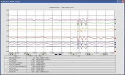
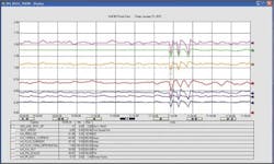
RID contracted Progress Technology Consultants (PTC) to undertake the project, and MWH Soft to develop the telemetry system using InfoWorks and FloodWorks modeling software. There are 17 telemetry points around the basin, monitoring rainfall, water levels, gate positions, and water quality (salinity, dissolved oxygen, pH, and temperature) that feed into the Control Room located at the Dam. The Control Room into which the telemetry feeds is located at the Dam.
The modeling and flood warning aspects of the project are based on MWH Soft's InfoWorks RS and FloodWorks software products. The models of the river basin were imported into InfoWorks RS with additional x–sectional data and topographical details, geo–referenced and linked to a detailed ground model. The model was then further developed to ensure stability over a range of flows and tidal levels, and water quality aspects were added.
The model was then linked to the telemetry sites by using the FloodWorks Configuration Manager Software (FWCMS), which then established the key forecast locations/nodes. The rainfall–runoff method used is Probability Distributed Model (PDM). Although the FloodWorks server is located at the Bang Pakong Dam Control Room, the system has a web feature which reports to the Flood Management Center located at the RID Head Office in Bangkok.
Author's note:Richard Body is the product sector leader for flood forecasting at MWH Soft. The company specialises in wet infrastructure engineering modeling, simulation and management software and professional solutions designed to meet the technological needs of water, wastewater, and storm water utilities, government agencies, engineering organisations and academic institutions worldwide. For more information please visit www.mwhsoft.com.
More Water & WasteWater International Current Issue Articles
More Water & WasteWater International Archives Issue Articles

