Product Focus: Mapping/Modeling/GIS
Stormwater Modeling
Streamline Technologies has recently added a new utility to its Interconnected Channel and Pond Routing model (ICPR) that calculates stage- rea-volume relationships for underground stormwater systems, including CULTEC plastic chambers Contactor® 100 HD and the entire Recharger® series. ICPR is used for a variety of stormwater management and drainage applications, including detention pond design, stormwater management master plans, flood insurance studies, drainage retrofits, and roadway drainage systems. The new ICPR version 3.10 includes a calculator that uses geometric data provided by manufacturers such as CULTEC to build necessary stage-area-storage relationships.
Streamline Technologies
Winter Springs, FL
800-828-SLTI
www.streamnologies.com
Mapping Software
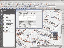
TerraGo Technologies has released Map2PDF Professional for Acrobat®, a solution designed to automatically create mapbooks in the GeoPDF® format, the only data distribution and collaboration format that leverages the Adobe Portable Document Format (PDF) to give users powerful mapping functionality and capabilities via Adobe Reader®. Mapbooks created with the software provide timely and easy access to intelligent, interactive sets of maps for municipal water management and utility personnel who need geospatially-enhanced maps to respond quickly and efficiently to emergency situations and also manage and maintain infrastructure. Mapbooks represent a cohesive collection of information that allows novice map users to locate and work with the data as opposed to focusing on the software. Additional features of Map2PDF Professional include: batch georegistration, index map creation, and adjacency hyperlinks.
TerraGo Technologies
Atlanta, GA
866-453-1609
www.terragotech.com
Flood Forecasting Software
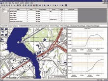
Wallingford Software has released FloodWorks v9.0, a real-time flood forecasting and warning software solution. Two significant advances head a large number of feature enhancements in v9.0: the ability to include wastewater and stormwater models within FloodWorks and the direct integration of radar data into FloodWorks. Wastewater (InfoWorks CS) and stormwater (InfoWorks SD) models can now be integrated directly into the FloodWorks forecasting system. Outfalls from InfoWorks CS and InfoWorks SD models can be connected directly to existing InfoWorks RS models of river and floodplain areas to provide a more accurate and comprehensive representation of the runoff from urban areas and its contribution to overall flooding. The new radar functionality in FloodWorks v9.0 directly reads raw radar images and processes the data into individual sub- catchment time series using polygons defined within FloodWorks configuration manager.
Wallingford Software
www.wallingfordsoftware.com
CUES GPS Backpack
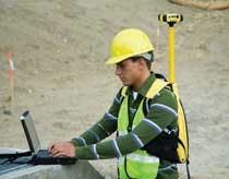
The CUES GPS Backpack Mapping Kit allows field-users to collect submeter accurate GPS coordinates with a "hands free" operation to conduct asset inspections and perform data entry while using a mobile PC. The kit works with the Granite XP Software and, optionally, the Granite XP ESRI module, to quickly provide an easy and accurate locating solution to field crews. The kit provides the ability to display/record Sewer (Manhole & Lateral Assets), Storm, Fiber, and Gas Pipeline coordinates from a GPS receiver and transfer the information seamlessly to Granite XP to map the location of the assets. A Trimble ProXT receiver is included for a complete turnkey solution.
CUES
800-327-7791
www.cuesinc.com
Geospatial Products
Bentley Systems offers a comprehensive new geospatial product portfolio with powerful GIS capabilities that supports infrastructure engineering workflows across the entire asset lifecycle, from planning, design, and construction to operations and decommissioning. These products synthesize engineering and geospatial workflows, dispensing with data silos and bridging the traditional divide between GIS specialists and the engineering community. By delivering GIS technology and other spatial information seamlessly and transparently to engineers when they need it, organizational efficiency is increased, errors are decreased, and data quality is improved. Newly introduced products in the portfolio include Bentley Map and Bentley Cadastre as well as Bentley Geospatial Server — all of which extend the company's portfolio of existing geospatial products.
Bentley Systems Inc.
Baltimore, MD
www.bentley.com
