Modeling Helps Predict Water Quality, Pollution Effects of Rezoning Effort
by Srinivasan Rangarajan
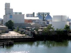
For many years, the Greenpoint and Williamsburg neighborhoods of North Brooklyn, NY, have been zoned for manufacturing and special mixed–use. A decline in heavy manufacturing and pressure for greater residential use prompted the city to look at changing this designation to include more residential properties, including a waterfront park, and limited light industrial use.
Projected developments were considered likely at 76 sites over a 10–year period, with a further 264 sites targeted for possible development. This, in two projected scenarios, was predicted to add over 7,300 dwellings to the area and over 250,000 square feet of commercial or retail space, as well as associated service space such as vehicle areas and manufacturing sites.
As part of preparing the proposal, consulting firm HydroQual was charged with modeling the impacts of the proposed developments using InfoWorks CS software, which the New York City Department of Environmental Protection (NYCDEP) is currently using to develop its long–term CSO control plan.
Impact Statement
The resultant modeling became part of the rezoning project's Final Environmental Impact Statement (FEIS), which covered all of the potential impacts on the area. This included a summary table showing, for every CSO outfall, the annual frequency and volume of overflows, both with and without the effects of the proposed rezoning.
In order to limit stormwater flows to within the existing sewer system's capacity, the NYCDEP required stormwater detention for all existing and proposed developments connecting to the area's combined sewer system wherever the site's storm flow would cause the system to exceed its capacity. Stormwater generated by new development on the waterfront could be discharged directly into the East River without detention, subject to New York State Department of Environmental Conservation (NYSDEC) and NYCDEP requirements.
For the FEIS, the modeling software was used to predict the frequency and volume of CSOs within the entire Newtown Creek service area (which also takes wastewater from parts of Manhattan and Queens) and to determine the pollutant loadings, if any, from those overflows. To obtain a cumulative assessment of CSOs from the entire drainage area, anticipated future developments (both with and without the proposed rezoning) and their impacts on dry weather sanitary flows were considered across the rezoning area, as well as other developments anticipated throughout the Newtown Creek wastewater treatment works service area.
Modeling
The volume of CSO overflow was calculated based on available precipitation data from the National Weather Service Central Park rain gauge for 1988, which was seen as a typical year. The model was set up and calibrated not under this project but under other CSO planning projects undertaken by HydroQual and Hazen & Sawyer for the NYCDEP.
The first steps in the original setup process involved obtaining drawings of the sewer system and its major components. These were reviewed to assess and incorporate those elements that could influence sewer performance.
In addition, infiltration/inflow drawings and regulator improvement program reports developed by the NYCDEP provided additional information on the sewer connections within individual regulator tributary areas and regulator chambers.
One or more sewer segments upstream of each regulator were included in the model, in addition to the regulator and interceptor configurations. The regulator drainage areas encompassing the project area were characterized in detail by including several sewer segments, and associating the corresponding runoff–contributing areas with individual manholes included in the model.
Most of the outfalls in the Newtown Creek drainage area are submerged at some point in the tidal cycle, so representing the tidal influence on them was critical to characterizing sewer system performance. Tide data compiled at Battery Station by the National Oceanic and Atmospheric Administration (NOAA) was used to set the tides at each of the outfall tide gauges affected by East River tides. Tidal correction factors were used to develop estimates of tidal variations near each of the combined sewer outfalls, and these were included in the hydraulic model.
Because little historical data was available, census data was used to develop initial dry weather flow estimates. The model was calibrated for wet weather conditions by reviewing appropriate hydrologic and hydraulic model parameters and adjusting as necessary.
Sewer flows were simulated for a one–year continuous period representing the year 2013, both with and without the predicted rezoning impacts, and outputs of CSO overflow volumes were examined on an hourly basis.
Conclusions
Because flows from the whole Newton Creek area affect CSO discharges, the FEIS did include an analysis of the cumulative impacts on CSOs from all planned developments in the Newtown Creek plant area and other projects, including parallel rezoning and major developments such as the development of the World Trade Center site in lower Manhattan and a possible Olympic Village.
The modeling found that the increased sanitary sewage generated by the proposed action would not have any significant impacts in terms of water quality changes caused by increased effluent flows from the Newtown Creek wastewater treatment plant or increased pollutant loadings from CSOs. It also found, because of the proposed park and the NYCDEP's stormwater detention requirements, that the proposed action was likely to reduce rather than increase the amount of stormwater entering the combined sewer system.
About the Author
Dr. Srinivasan Rangarajan is an associate engineer at HydroQual Inc. (Mahwah, NJ), and a leading expert in environmental and water resources engineering. He can be contacted at [email protected].


