Flood forecasting in real time
The performance of flood forecast models must be evaluated regularly and a continuing cycle of model recalibration carried out after a new flood event to provide a current, useful, and accurate flood forecasting tool.
By Yiping Chen, Geoff Graham
River floods can cause loss of life, devastating damage to properties and adverse economic and environmental impacts. Although flood risks cannot be completely eliminated, real time flood forecasting models, as an important and integral part of a flood warning service, can help to provide timely flood warnings with an adequate lead time for the public to minimize flood damages.
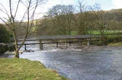
Photo by Atkins Limited
Two types of real time flood forecasting models include simple trigger flood forecasting and more sophisticated catchment-wide integrated hydrological and hydrodynamic models.
Approximately five million people, in two million properties, live in flood risk areas in England and Wales. Autumn 2000 saw some of the worst floods ever recorded in the UK and raised public awareness of potential flood risks. It is now well recognized that flood risks can be reduced but can never be completely eliminated. Hence in recent years there has been a significant move from a strategy of flood defense to one of flood risk management; therefore it is important to provide an effective and reliable flood warning service as part of the flood risk management process. Flood warnings must be provided with an adequate lead time for the public and the emergency services to take actions to minimize flood damages.
Real time flood forecasting is an important and integral part of a flood warning service, and can help to provide more accurate and timely warnings. Depending on catchment characteristics and catchment response to rainfall, various types of flood forecasting models, including correlations, simple trigger flood forecasting, and more sophisticated real time catchment-wide integrated hydrological and hydrodynamic models may be adopted. These models provide flow and level forecasts at the selected key locations known as Forecast Points, which are usually located along major rivers or on streams near urban areas that have a history of flooding.
The UK Environment Agency’s National Flood Forecasting System (NFFS) is an innovative operating shell enabling many different types of forecasting models to be used in real time within its open architecture. In order to maximize the benefit of the NFFS and to provide an effective flood warning service, it is necessary to populate the NFFS with flood forecast models. The NFFS has already been in operational use for Southern, Midland and Northeast Regions since 2005, and will be extended into all regions in England and Wales from 2006.
The UK consultancy Atkins has been working with the Environment Agency in recent years to develop real time flood forecasting models for NFFS implementation for different regions.
Simple trigger flood forecasting method
The simple trigger flood forecasting method provides early warning of the onset of flooding to a specific flood warning area and can also provide an independent backup to more sophisticated forecasting methods, such as real time integrated catchment models combining rainfall runoff, flow routing and hydrodynamic processes. The simple trigger method provides information that a pre-defined flood warning threshold will be reached if the current rate of rise is maintained. The simple trigger flood forecasting tool can be implemented either on the regional telemetry system or the NFFS.
The key features of the simple trigger flood forecasting method include flood warning area analysis, flooding thresholds analysis, rate of rise analysis and implementation. An application of this method for the Sankey Brook catchment illustrates these features.
The headwaters of the Sankey Brook catchment are drained by a complex system of tributaries that rise north of Rainford, Cheshire, England. They collectively form Sankey Brook proper in the township of St. Helens. The watercourse then flows in a southeast direction for approximately 17.5 km to its confluence with the River Mersey near Penketh. Three flood warning areas in this catchment have been identified based on the flood risk assessment/modelling results. The nearest gauging station is located at Causey Bridges and gauges the river flow covering a catchment area of about 150 square kilometers. The development of the flood warning triggers relied upon the gauge data recorded at the Causey Bridges gauge only, which has been in operation since 1953. A short record also exists for Higham Avenue and Liverpool Road gauging stations. A peak-to-peak correlation analysis was undertaken to relate levels at Higham Avenue and Liverpool Road to Causey Bridges gauge.
Flooding thresholds for the three flood warning areas were established following an analysis of return periods of flooding for each discrete flood risk area.
A rate of rise analysis was undertaken to determine the catchment response and the feasibility of developing flood warning triggers based on the rate of rise of the stage hydrograph at Causey Bridges gauge. Hydrograph rising limbs were extracted from the observed and design events and analyzed. Sankey Brook is not particularly flashy and the response of the catchment indicates sufficient time to issue flood warnings based on simple trigger flood forecasts. The rate of rise information is then used to develop the flood forecast with the lead time requirement for each flood warning area. For example, a 2.50-hour lead time water level forecast can be predicted as:
- Stage(t+2.50) = Stage(t) + {Stage(t) - Stage(t-1)}*2.50
- where Stage(t) and Stage(t+2.50) are the water levels at time now and 2.50 hours ahead respectively and Stage(t-1) is the water level one hour before now. The water level forecast can then be compared with the flooding thresholds to determine if a flooding threshold will be reached during an event.
This simple trigger flood forecasting tool provided a quick and easily implemented method to help the Environment Agency extend its flood warning coverage. A novel spreadsheet tool has been developed for easy implementation and verification of the simple trigger method. This tool was tested for nine flood events achieving adequate lead time of at least two hours for 75 percent of occasions when the lowest trigger level was reached.
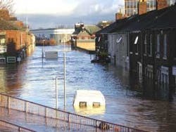
The recent January 2005 flood event that affected Carlisle and other parts of Northwest Region were the first major event since the implementation of the simple trigger models developed by Atkins. A review of the flood warning performance in the Northwest Region revealed that 13 out of 18 (72 percent) simple trigger models provided at least two hours lead time and only one false alarm was generated. The worst affected area at Carlisle was forecast to be flooded with 3.5 hours lead time.
Catchment-wide integrated hydrological and hydrodynamic modeling
The catchment-wide integrated hydrological and hydrodynamic modelling approach provides a more robust and sophisticated flood forecasting, since hydrological rainfall runoff processes and river channel and floodplain hydrodynamic processes are explicitly simulated. A flood forecasting model will typically comprise of a hydrological component in which flood discharges are estimated from rainfall measurements and forecasts, and a hydrodynamic component, in which the water levels along the entire river network are calculated.
In principle, flood forecasting models can be developed to meet the forecasting requirements, but it is often more economical and efficient to convert existing flood risk mapping/flood defense scheme design models for real time flood forecast applications, since these models will also include the similar hydrological and hydrodynamic components. However, significant differences exist in these two types of models, resulting in mapping/design models to be unsuitable for direct real time applications for two main reasons. First, the unit hydrograph-based hydrological rainfall-runoff modules, which are typically used in mapping/design models, are mostly event-based with static parameters and the initial conditions (e.g Standard Percentage Runoff) would need to be determined before each model run.
Second, the model runtime is usually not considered as an important design criterion when mapping/design models are developed. Consequently, it is not unusual for models to run for several hours to simulate water levels over the entire river network. Runtimes of this order are clearly inappropriate for real-time forecasting to deliver a timely flood warning service. It is also common for mapping/design models to simulate the possible worst scenarios with regards to sluice and reservoir operations whereas real-time applications must consider actual operations for sluices and reservoirs. Nevertheless, although the existing mapping/design models are often not suitable for direct incorporation into a forecasting system, they do provide an excellent basis for developing forecasting models by converting the design models for real-time operational use.
The primary tasks of model conversions include reconfiguration of the hydrological component enabling conceptual rainfall runoff modelling (e.g. PDM - Probability Distributed Moisture - model) and real time updating, and improvement of the hydrodynamic component in model stability and model runtime. As a result of these changes, the resulting forecasting model must be re-calibrated and validated to determine whether it meets the required accuracy specification at the forecasting points.
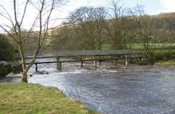
Photo by Atkins
During 2004-2005, Atkins undertook one of the first real time catchment-wide integrated hydrological and hydrodynamic model development projects for the NFFS for the Sussex Ouse catchment in the Environment Agency’s Southern Region. The Sussex Ouse is a complex catchment with a significant number of braided channels and strong channel - floodplain interactions. The Sussex Ouse catchment covers an area of over 560 square kilometers and was represented by four separate flood risk mapping models (Upper, Middle and Lower Ouse and Uck). These models were reviewed to identify key features to be retained within the model to achieve the accuracy specifications at the forecast points and other less important features for simplifications/modifications. These four mapping models were converted into four flood forecasting models to deliver real time flood forecasts for 17 forecast points. Altogether 38 hydrological rainfall runoff models were developed using PDM. The flood forecasting models were calibrated in off-line mode using daily rainfall, flow and level data over a period of 14 months and 15-minute data for three major events lasting 12 to 18 days.
The model runtime improvement was a key technical challenge and also a key success of the project. For example, the Uck forecast model, for which the model schematic took less than four minutes for a 456-hour (19 days) simulation as opposed to the original mapping model’s 38 minutes for a 33-hour simulation, achieving more than 100-fold runtime improvement. Likewise, the tidal Lower Ouse forecast model (with 460 nodes) took only 37 seconds for a 470-hour simulation. All four Sussex Ouse forecast models were delivered to the Environment Agency and the implementation of these models on the NFFS will significantly improve the Agency’s flood forecasting service and flood management capability in this catchment.
Following severe flooding in January 2005, Atkins undertook a similar project to improve the Eden/Carlisle hydrodynamic flood forecasting model, based on an existing flood defense strategy model. The newly converted Eden/Carlisle flood forecasting model (with 1100 nodes) is robust and stable, incorporates the key hydraulic features of the strategy model, and retains all of the originally modelled floodplains within the required model extents, with a typical model runtime being in the range of 0.5 to 1.5 minutes for an 80-hour simulation of various flow conditions on a 3.2 GHz PC.
Summary
Simple trigger flood forecasting is simple and easy to implement. It provides an early warning of the onset of possible flooding. It can use either a fixed rate of rise or a variable rate of rise approach and can also provide an independent backup to more sophisticated integrated catchment flood forecasting models. The catchment-wide integrated flood forecasting models simulate the hydrological and hydrodynamic processes and can provide a more robust flood forecasting for the whole catchment. The integrated catchment models represent the rainfall-runoff and the channel - floodplain processes more accurately and can provide accurate and timely flood forecasts.
A flood forecast model usually works well within the range the model has been calibrated for, but may not always provide accurate forecasts of flooding when it is operating for extreme floods larger than the ones used to calibrate the model. It is a vital part of the forecasting process to monitor and assess continuously the recorded water stages during an event.
Even a well-calibrated model is an ephemeral commodity. Once a river model has been developed, changes in catchment characteristics, such as increasing urbanization, drainage improvements, and construction of flood defenses and development of farm lands, can make the model obsolete. It is therefore important to evaluate the performance of the flood forecast models regularly and apply a continuing cycle of model recalibration after a new flood event to provide a current, useful, and accurate flood forecasting tool.
Authors’ Note
Yiping Chen and Geoff Graham of Atkins Limited’ Water & Environment division are based in Warrington, Cheshire, England. For more information, visit www.atkinsglobal.com or contact by email: [email protected].


