Bay of Plenty Regional Council raises the bar for environmental data management
Key Highlights
- BOPRC expanded its AQUARIUS platform from hydrological data to include water quality, air quality, coastal ecology, geothermal, and water use datasets, enabling holistic environmental monitoring.
- Implementation of NEMS standards and metadata capabilities ensures high-confidence, nationally consistent data, supporting reliable decision-making and public reporting.
- Survey123 field data capture streamlines collection, reduces errors, and allows real-time data integration, enhancing the accuracy and timeliness of environmental information.
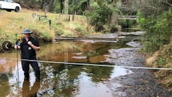
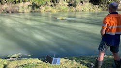
The Bay of Plenty region on New Zealand's North Island has a diverse landscape - from pristine coastlines and geothermal wonders to native forests and fertile plains. As caretakers of this ecosystem, the Bay of Plenty Regional Council (BOPRC) faces the complex task of monitoring and collecting data on environmental aspects across land, air, and water ecosystems.
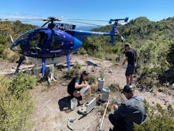
With over 9,000 monitoring stations and counting, the council's environmental data collection has expanded significantly. Team Leader for Environmental Data and Information at BOPRC, Angela Perks, explains. "Our mandate continues to expand to include broader environmental, social, and cultural interests of our community. This has pushed our team to expand the capabilities of our data management system."
From hydrology to holistic environmental monitoring
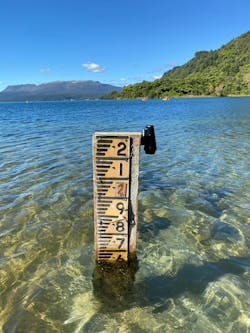
In 2014, BOPRC implemented AQUARIUS as their data management platform, initially focusing solely on hydrological data — rainfall, groundwater, river levels, and flow measurements. The success of this implementation quickly revealed expansion opportunities.
"What began as a hydrology-focused deployment evolved into our central environmental data hub," says Perks. "We've methodically expanded our use of the platform to integrate discrete water quality data from our LabWare system, air quality monitoring data from the Mount Maunganui area, coastal ecology datasets, water use data, geothermal information, and so much more."
This evolution has transformed how the council approaches environmental monitoring. By consolidating diverse datasets in one system, BOPRC can now identify correlations and patterns that would potentially have previously gone unnoticed.
For instance, when air quality sensors in the Mount Maunganui area detected elevated levels of particulate matter less than 10 microns (PM10) in 2018, the Council could correlate these readings with industrial activities, weather conditions, and other environmental factors.
The Mount Maunganui airshed was gazetted in 2019 and designated as polluted that year due to breaches of New Zealand's National Environmental Standards for Air Quality for particulate matter (PM10), primarily from industrial discharges. This designation has enabled the Council to impose stricter rules and resource consent decisions, and along with changes by key industries, there have been measured improvements since. The airshed will remain classified as polluted until there are no breaches of the Standard for five consecutive years.
The gold standard in data quality
By adopting the NEMS quality coding framework in AQUARIUS, BOPRC has elevated its environmental data to nationally consistent, high quality and high-confidence data. "Adopting NEMS standards has been a great achievement,” notes Perks. "These represent rigorous standards for data collection, accuracy, validation, and reliability, making our environmental data more trustworthy for high-stakes decisions and public reporting."
This improvement has been aided by the platform's metadata capabilities, which link critical details, such as field visit measurements, photographs, comments, and measurement method metadata to each dataset. The system maintains comprehensive audit logs of all corrections and metadata changes, supporting data integrity and defensibility.
"The data review toolbox is my all-time favorite feature," says Perks. "It allows for simultaneous raw and corrected data viewing with a comprehensive audit trail, which is invaluable for maintaining data quality and transparency."
Innovation in field collection and qualitative data
The council implemented Survey123 for field data capture in December 2020. Automating the collection process ensures information is available immediately after collection, rather than being delayed until field staff return to the office. This approach minimizes input errors from transcribing handwritten notes and allows field crews to enhance datasets with supporting images and contextual information in the field visit sections.
For geothermal monitoring, which includes bore temperature profiles, surface feature monitoring, and fluid chemistry, BOPRC developed a method to convert qualitative observational data into numerical data. This enables a more comprehensive view of geothermal resources and supports BOPRC in delivering key functions under the Resource Management Act and other statutory or non-statutory requirements.
"We've found creative ways to represent qualitative information through qualifiers, notes, and legends," explains Perks. "For example, observational data, such as odor and water color of geothermal surface features, can indicate changes in chemical composition and activity. This data, previously hidden in attached Excel files, is now visible as time series alongside measured data, which also enables trend analysis.”
Blending cultural knowledge with data science
A new forward-thinking initiative involves exploring ways to incorporate Mātauranga Māori — traditional Māori knowledge — into data management practices.
Mātauranga Māori is a holistic, place-based, and intergenerational perspective that often complements scientific approaches. In Māori culture, descriptions of the environment go beyond data. BOPRC is looking for a richer understanding of environmental phenomena by bringing both qualitative and quantitative aspects to data. By embedding values such as kaitiakitanga (guardianship), whanaungatanga (relationships), and tikanga (customs), the council is hoping to make data collection more culturally relevant and locally informed.
"Indigenous knowledge systems provide insights that conventional monitoring might miss," says Perks. "By creating space for Mātauranga Māori within our data frameworks, we're acknowledging that effective environmental stewardship requires more than just scientific measurements."
Empowering stakeholders through data access
BOPRC uses AQUARIUS WebPortal to provide public access to quality-assured environmental data. This self-service approach has reduced the time staff spend fulfilling manual data requests, while empowering diverse stakeholders, such as consultants, universities, farmers, and community members, to engage with environmental information.
The council has developed custom reports for specific user groups. Farmers, for instance, can access specialized reports on soil moisture and other agricultural indicators to make informed irrigation decisions. Universities and research institutions use the data portal to support environmental studies.
"Our data portal has democratized access to environmental data," says Perks. "When people can easily access and visualize information about their local environment, they become more engaged and can make better decisions about protecting our resources."
Looking ahead: The future of environmental data management
As BOPRC continues to expand its monitoring networks, the council continues to push the boundaries of what is possible in its data management systems.
The Rating Review toolbox has become increasingly valuable as climate change affects rainfall in the region. Having centralized storage of all environmental data, metadata, and supporting documents in one system enables the council to respond more effectively to these emerging environmental challenges.
"What began as a solution for hydrology data has evolved into the backbone of our environmental monitoring and management program," concludes Perks. "By raising the bar for data confidence, integration, and accessibility, we're better positioned to fulfill our mandate as caretakers of the Bay of Plenty's natural resources for current and future generations."
About the Author

Thalia Kouts
Thalia Kouts is customer success manager for Aquatic Informatics. She supports water professionals in maximizing the value of data management tools.


