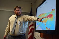
GIS Touches Every Aspect of Central Arkansas Water
Esri’s ArcGIS is a framework for gathering, managing, and analyzing data. Rooted in the science of geography, geographic information system (GIS) technology integrates many types of data. It analyzes spatial location and organizes layers of information into visualizations using maps and 3D scenes. With this unique capability, ArcGIS reveals deeper insights into data — such as patterns, relationships, and situations — helping users make smarter decisions.
Central Arkansas Water (CAW) is using ArcGIS to integrate business systems and enable field and office workflows. Easy-to-use maps and apps provide staff with quick access to the information they need, improving efficiency.
Main Breaks
Using iPads, field crews can view historical main break locations and related data: age of pipe, material type, repair history, and as-built plans. A hydraulic model is linked with ArcGIS providing additional information about pressure. And the integration with Cityworks streamlines work management.
Inspections
Configurable maps and apps enable field workflows that support in-house fire hydrant and valve inspections. This saves CAW more than $1 million every five years.
Billing
Rates and fees are set using maps that provide access to sanitary sewer, sanitation, improvement districts, debt service districts, ZIP codes, and more. Integration with Cityworks automatically assigns service orders.
Customers
Water quality complaints from the customer information system are mapped in ArcGIS to reveal patterns and trends. This information supports proactive steps to reduce complaints.
Sanitary Sewer
Water consumption data is analyzed to support capacity planning for the collection system.
Engineering
Construction projects are managed using a map that includes construction drawings and as-built plans. Up-to-date project information is available with a single click.
Water Resources
Natural resource managers visualize water flow, enabling them to identify potential water quality concerns, supporting watershed protection of Lake Maumelle and Lake Winona.
Maintenance
Integrating ArcGIS and LiGO GPS provides fleet managers with real-time vehicle location, inventory, and optimized routing. This has improved productivity, work efficiency, fuel management, and worker safety.
“GIS provides a lifeline from the workers in the field to critical information to help them on a daily basis, whether it’s being able to quickly locate a valve, isolate a main break, or to find a meter to assist a customer,” said Blake Weindorf, chief operating officer at CAW. “GIS enables us to have this information literally at our fingertips.” WW
Esri is exhibiting at ACE20, booth 4817. Learn more at go.esri.com.

